Comments: (0)

Dreamhamar, selected as BEST practice by the Dubai International Award

Category: ⚐ EN+architecture+dreamhamar+ecosistema urbano+news

Best Practice Database

Best Practice Database

This week we come with some good news in a row! Some days ago, we were notified that our project dreamhamar has been awarded as BEST PRACTICE by the UN at the Dubai 2014 International Award for Best Practices to Improve the Living Environment.

The Spanish submissions to this award have been highly appreciated: 62 of them were labelled as GOOD practices, 17 as BEST practices and 2 selected for the international AWARD.

From now on, the project will be part of the UN-HABITAT Best Practice Database. It’s our third project to join that list, together with the previously selected Plaza Ecópolis and the Ecoboulevard. The project will also be showcased in the Décimo Catálogo español de Buenas Prácticas and added to the “Ciudades para un Futuro más Sosteniblelibrary, CF+S” online library.

Here is a short video about the methodology (Dream Your City) we used in the dreamhamar project in Norway:

You can find more about the project on the www.dreamhamar.org website and on the recently published book “Dreamhamar: A network design process for collectively redesigning public space”, which explains the project’s actions and methods in great detail.

See the previous posts about dreamhamar.

Comments: (2)

Ecosistema Urbano, first prize in the Voronezh Sea Closed Competition

Category: ⚐ EN+competitions+ecosistema urbano+news

Aerial view of the "Leisure Island"

Aerial view of the “Leisure Island”, one of the proposals

The Department of Natural Resources and Ecology of the Voronezh region decided recently to organize a closed competition in order to develop a strategy for the future of the Voronezh Sea, a currently contaminated reservoir. The aim was to gather ideas on the use of the reservoir so it can be more attractive for the population and be a resource for the development of the city once the water is clean.

Today we are pleased to announce that our proposal has been awarded the first prize!

Click on the image to see some cool panoramas of the Voronezh Sea!

Click on the image to see some cool panoramas of the Voronezh Sea!

The proposal developed by Ecosistema Urbano after being selected for the second round of the competition works at different levels, addressing both the diverse sources of contamination and the potential uses of the existing reservoir. Our vision combines various solutions bringing new opportunities for leisure and activities for people to enjoy and experience the lake.

Our proposal

Addressing the different sources of pollution by providing customised solutions for each of them. These actions are framed as Phase 0. Among the actions we propose to place macrophytes on the surface of the water treatment plant tanks. This action can improve the performance of the Plant up to 40% and it is more efficient not only in the short term, but also in the long run as it reduces energy consumption and requires low maintenance.

Working with floating macrophytes which can absorb many different contaminants. They would be located in the shallowest areas of the lake to stop algae from blooming and emitting a specific smell that comes from the reservoir in summer.

Floating macrophytes in action

Floating macrophytes in action

Creation of bathing areas both in the urban and at the natural environment of the lake, incorporating the macrophytes as part of the water purification system.

A series of floating mobile cleaning infrastructures. These barges help to control water eutrophication as it is important to reduce the amount of phosphorus. They have tanks filled with alum for phosphor sedimentation at the bottom and incorporate various leisure programs and possibilities on the top, so they can be used in different areas of the city during the summer season. At the same time, these floating barges include sampling and analysing systems so that real time information about the water conditions and quality is made available for everyone through the web platforms and mobile app, specifically developed for this purpose.

Floating mobile cleaning infrastructures

Floating mobile cleaning infrastructures

Two areas are proposed to be developed through Public-Private Partnership. These new developments will help to shape a new identity for Voronezh and a new relationship of the city with the water.

The first is a mixed-use zone including housing, offices, retail, public and cultural buildings etc. This new development must be a pilot experience incorporating all the current sustainable technologies, as well as incorporating good practices in water management. Rainwater and surface water runoff is collected and purified through small ponds with floating macrophytes for being used afterwards for irrigation. Pump system for ponds and aeration fountains receive energy from micro wind turbines located on the shore.

New development of a mixed-use zones at the lakefront

New development of a mixed-use zones at the lakefront

As a second development opportunity, ecosistema urbano proposes turning the existing Pridachenskaya dam into a Leisure Island with different activities, becoming a new infrastructure for the city incorporating clean water areas available for swimming and bathing. The island also includes bicycle and jogging paths, boat station for water-sports, urban beach, gardens and parks, playgrounds and sport facilities.

Typologies of cleaning and activity-hosting infrastructures

Typologies of cleaning and activity-hosting infrastructures

Next you can see some more images of the proposal, showing how water treatment and environmental regeneration could work together with social reactivation of the reservoir along the day and through the seasons.

Swimming-pools

Leasure-Island-Day

Leasure-Island-Night

Eco-path

Related links (in Russian):

EU project ideas
Results of the competition
Voronezh news

Comments: (3)

Renovando nuestra infraestructura web

Category: ⚐ ES+ecosistema urbano+eu:live

newserver

Habréis notado que —aparte de un par de noticias importantes como el Plan Maestro de Asunción o la presentación del libro Networked Urbanism— estos días el blog ha estado un poco más parado de lo habitual.

Estamos arrancando un período de actividad intensa en Ecosistema Urbano, abordando a la vez el desarrollo de nuevos proyectos internacionales y la reestructuración interna tanto en términos de equipo humano como de equipamiento e infraestructuras. Uno de esos cambios afecta directamente a nuestra presencia en línea: el servidor virtual privado —VPS— que hemos estado utilizando durante los últimos años empezaba a exigir más mantenimiento con la creciente carga de visitas sobre nuestras páginas, así que hemos aprovechado para moverlas todas a otro lugar.

La solución ha sido, paradójicamente, cambiarnos a un servidor más pequeño y sencillo pero optimizado para llevar mejor la carga. Llevamos pocos días funcionando pero de momento, sólo con el cambio de servidor, todas nuestras páginas han pasado a cargar prácticamente en la mitad de tiempo que antes, así que parece prometedor.

Terminada la migración iremos retomando el ritmo habitual de publicación, y en adelante iremos aplicando otras mejoras y medidas de optimización que hemos estado estudiando con el fin de ir reduciendo aún más el tiempo de carga de las páginas y la presión sobre el servidor.

Si a alguien le interesan los detalles técnicos, que pregunte en los comentarios :)

¡Seguimos!


Comments: (0)

Ecosistema urbano selected for the second round of the Voronezh Sea Closed Competition

Category: ⚐ EN+competitions+ecosistema urbano+news

Voronezh and the reservoir - image via prorus.net - click to visit source

Voronezh—which became popular in the late 80s because of a controversial UFO incident—is a city of over 1 million inhabitants, situated 500 km south of Moscow. It is located on the banks of the Voronezh River, which in 1972 was transformed into the Voronezh Reservoir or “the Voronezh Sea” as it is called by the inhabitants —a huge lake, 30 km long and 2 km wide. You can read more about the history of the reservoir here.

During the following decades the population enjoyed the cool water during the hot Voronezh summer, but in 1992 the authorities labelled it as “not fit for swimming” as a result of the increasingly polluted water.

Click on the image to see some cool panoramas of the Voronezh Sea

Click on the image to see some cool panoramas of the Voronezh Sea!

The Department of Natural Resources and Ecology of the Voronezh region recently decided to organize a competition in order to develop a strategy for the future of the Voronezh Reservoir. The competition consists of two parts:

  • An Open Ideas competition meant to gather ideas that show the potential of the lake for urban and nature development.
  • A Closed Competition for teams of landscape architects, urbanists and ecologists that should combine ideas about possible future uses of the lake with technologies for cleaning it up. The strategy should include both a project and proposals for implementation.

We are glad to communicate that we have been selected among the four finalists of the closed competition. Over the following weeks we will be working hard on putting together a creative approach and a comprehensive strategy in a great presentation. More news soon!

Related link: Report of the jury

Comments: (0)

Claire Cassanet | eu collaborators

Category: ⚐ EN+colaboradores+ecosistema urbano

Today we introduce you to Claire Cassanet, a young landscape engineer who just left the office after four months of internship. We worked and learned together, we cooked together, we enjoyed every day in her cheerful company. We already miss you, Claire! Read on as she describes her experience with us…

Claire!

Claire!

continue reading

Comments: (0)

Empoderamiento y TICs | Entrevista a ecosistema urbano en empodera.org

Category: ⚐ EN+⚐ ES+colaboraciones+cultura abierta+ecosistema urbano+internet+open culture+publicaciones+publications+social software+social toolbox+software social

dreamhamar.app por Ecosistema Urbano

dreamhamar.app por Ecosistema Urbano

Hoy publicamos una entrevista que nos realizaron desde empodera.org, una plataforma de impulso para personas e iniciativas que utilizan las tecnologías desde un punto de vista social e innovador para hacer una sociedad más inclusiva y empoderada.

“Ecosistema Urbano: diseñando lugares para mejorar la auto organización de los ciudadanos, la interacción comunitaria y su relación con el medio ambiente”

Acceder a la entrevista en empodera.org

La entrevista se incluyó en la publicación Ciberoptimismo: Conectados a una actitud (pág. 287), una selección de entrevistas y experiencias sobre cómo las tecnologías han cambiado definitivamente nuestra interacción con diferentes temas (procomún, nuevas formas de economía, plataformas abiertas para todos, educación, software libre, transparencia, open government, participación ciudadana, sostenibilidad, etc.).

Aquí podéis descargar el libro español-inglés bajo licencia Creative Commons:
Ciberoptimismo: Conectados a una actitud – Ciberoptimism: connected to an attitude
empodera.org es una iniciativa de la Fundación Cibervoluntarios.

¡Que lo disfrutéis!

The launch of dreamhamar.app. - photo: Christoffer Horsfjord Nilsen

The launch of dreamhamar.app by Ecosistema Urbano – Photo: Christoffer Horsfjord Nilsen

continue reading

Comments: (3)

LibreLigne | Urban acupuncture in Libreville, Gabon

Category: ⚐ EN+city+competitions+ecosistema urbano+landscape+news+urbanism

Concept draft of the piers as urban catalyzers

Concept drawing of the piers as landmarks

Ecosistema Urbano was recently selected as one of the five finalists in a competition of ideas for the waterfront (Bord de Mer) of Libreville, capital city of Gabon. We were selected by the committee of the Agence Nationale de Grand Travaux du Gabon among many other proposals. In their own words, the proposal “has strong linkages to existing urban systems, improves coastline’s connections and celebrates Libreville culture and history.” Here is a brief descripton of the project:

The main goal of our proposal is to reunite Libreville with the seashore, and extend the life of the city to the waterfront in some specific points. This would be achieved through operations of urban regeneration, adjusted to the existing and to the specific cultural, sociological and economical context. The proposal concentrates visual impact, identity and activity in five nodes, instead of spreading them too thin along the promenade.

Plan of the coastal line of Libreville, in two sections

Plan of the coastal line of Libreville, in two sections

Those five pier-like structures (jetées) are a great way of getting closer to the water, of having a unique view of the city and at the same time of providing space for programs that could work as catalysers of the urban life. They act as unique landmarks, breaking the regularity of the very long promenade and facilitating the orientation of citizens. These points of “urban acupuncture” would drag attention and pull the urban life of Libreville to the seashore, providing a new space for citizens to interact.

Vertical section of the biggest 'jetée'

Section of the biggest ‘jetée’

Section of one of the piers

Section of one of a longer and lower pier structure

Section through the beach

Section through a beach area, where the promenade is reduced to the minimum

The locations and uses of the piers are defined in relation to the city: to its flows, to the activity of the closest neighbourhoods and to the most relevant uses, buildings or public spaces nearby. Following that close relation with the surroundings, each pier has a singular character defined by the size, the shape, the vegetation, the dominant colors and other design factors, but also by the specific set of activities that can be performed in them. This way, we have the pier of Nature, Education, Culture and Music, Local Identity and Water.

One of the pier structures evolving along the day

The use of the structures would change along the day

On the other hand, the linear promenade itself changes the configuration of its section depending, again, on the surroundings. Some key elements are defined in that section: the waterfront boulevard for (unavoidable) motorized traffic, a series of landscape markers (associated with energy production and visibilization), a coastal bike lane, a waterfront promenade, an urban appropriable fringe… This elements are combined, stretched or shrinked, generating diverse profiles and multiple areas of interest.

One of the "pelican" crossings in front of a pier

The crossings in front of the piers would be shared areas for pedestrian and motorists

Thus, while the promenade is kept simple, regular and clean, these structures act as landmarks, dividing the seafront in more aprehensible, walkable sections, and marking the coast like ‘signal fires’ or lighthouses: they provide visual clues to help the passer-by understand his exact location at a glance.

View from one of the piers

View from one of the piers

In addition, based on the rapidly rising mobile market penetration in Gabon, and as a bet on the potential of hyperlocalized digital networks for urban life, the proposal includes a digital application that would work as a geolocated and participatory cultural agenda for the waterfront, showcasing the activities along the line, attracting citizens and visitors, allowing them to search and follow events, and acting as a geographic map or guide.

Tentative screenshots of the application

Tentative mockup for the application, based on the previous proposal for ‘BikeLine’

This proposal was developed in collaboration with the landscape architecture office Uberland.

Comments: (2)

dreamhamar contado como nunca antes: presentación del libro y exposición

Category: ⚐ ES+dreamhamar+ecosistema urbano+publicaciones+urban social design

dreamhamar

dreamhamar es el proceso de network design que llevamos a cabo alrededor del rediseño de la plaza principal —Stortorget— de Hamar, Noruega. Este proceso creativo se inició como un concurso internacional de ideas en 2010 y en julio de 2012 entregamos el proyecto de ejecución de la plaza.

Poco hemos compartido durante este largo tiempo sobre el proyecto, el proceso participativo y las vicisitudes de abrir una pop up office y trabajar codo con codo con la comunidad local. Ha sido un proceso apasionante, intenso y lleno de todo tipo de anécdotas; una experiencia única que nos permitió trabajar sobre un espacio que literalmente habitamos durante 4 meses, ya que nuestra oficina estuvo localizada precisamente allí, frente a Stortorget.

Recopilar, ordenar, cribar y presentar la información producida ha sido una enorme tarea. La voluntad de mostrar y contar esta información en un libro nos ha obligado a realizar una labor de síntesis que por otro lado ha resultado muy esclarecedora. Con este post queremos contaros el proceso que hemos seguido, mostraros unas primeras imágenes del resultado e invitaros a su presentación en público.

dreamhamar book - interior

dreamhamar book – interior

Volver a contar la historia

Acabado el proceso participativo, que tuvo lugar entre los meses de agosto y diciembre de 2011, redactamos un informe para el ayuntamiento contando lo que se había hecho desde distintos puntos de vista. Nuestra idea inicial era pulir ese documento, convertirlo en un libro y hacerlo público. Pero pronto nos dimos cuenta de que para hacer todo el proceso inteligible y, sobre todo, facilitar el aprovechamiento práctico del conocimiento generado necesitábamos contarlo de otra manera. Tras meses de redacción y revisión en inglés y noruego, el resultado es una forma de contarlo, de muchas otras que podría haber, que creemos que es más estructurada y fácil de “navegar”, leer y consultar.

Revisar el proceso de forma (auto)crítica

Uno de los valores más claros de plantear una metodología definida aun sin precedentes directos es el de la experimentación. Pero ese valor no trascendería más allá de la experiencia concreta si no fuéramos capaces de extraer conclusiones con vistas a mejorar el proceso y repetirlo en otra ocasión. De modo que, junto a varios colaboradores del ámbito de la sociología urbana y la antropología, realizamos una revisión del proyecto, repasando las herramientas y metodologías utilizadas, explicitando nuestras propias impresiones tras la experiencia directa, destacando cosas que funcionaron bien y aspectos que habría que mejorar en el futuro, y tratando de condensar todo ello en una serie de conclusiones que pudiéramos compartir.

Clasificar, seleccionar y reelaborar materiales

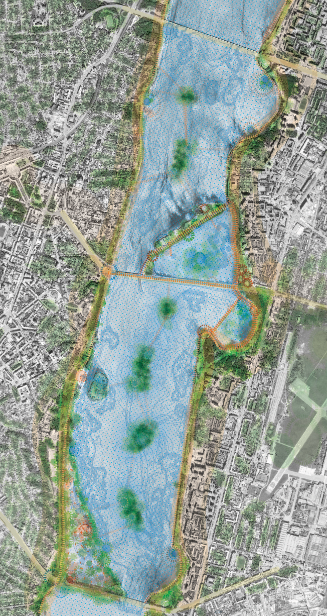
dreamhamar nos dejó con una cantidad ingente de materiales de todo tipo. Notas escritas en cuartillas y postales, comentarios y posts publicados en la página, paneles con propuestas de proyecto hechas por estudiantes, cartones con esquemas dibujados durante los talleres, dibujos hechos por los niños en las escuelas, documentos impresos y digitales, maquetas, vídeos y sobre todo muchísimas fotografías de todo el proceso. Desde el principio tuvimos claro que para poder mostrar y compartir posteriormente el proceso teníamos que poner especial cuidado en documentarlo muy bien, y así lo hicimos. El resultado es que, a la hora de recapitular y contar el proyecto, hemos echado en falta muy pocas cosas, pero nos hemos tenido que enfrentar a la difícil tarea de ordenar, cribar, seleccionar y formatear todo ese contenido que sí tenemos.

Maquetar, revisar, maquetar, revisar…

Y por último, montar el libro. Para ello contamos con Lugadero, una joven editorial de Sevilla que desde el principio vio muy claro el proyecto y apostó sin dudarlo por su publicación. Con ello comenzó un largo proceso de pruebas y maquetas para encontrar una estructura adecuada, y después un aún más largo proceso de revisión y ajuste. En la carpeta del proyecto tenemos cerca de 40 borradores llenos de anotaciones, correspondientes a otras tantas vueltas de revisión. Algunas parciales, otras específicas para revisión de textos o gráficos, y otras, la mayoría, mucho más completas y exhaustivas.

Y por fin… el libro

Gracias a la paciencia y dedicación de todos los que han participado en esto, podemos por fin presentar una edición muy cuidada que, esperamos, permitirá al lector entender el proyecto en su totalidad y revisar al detalle nuestras reflexiones y conclusiones sobre lo que fue una gran experiencia piloto de network design y de lo que nos gusta llamar diseño social urbano.

dreamhamar book

dreamhamar book

Este es el libro que estaremos presentando en Lugadero mañana martes, aprovechando para inaugurar una exposición con materiales complementarios, algunos traídos casi directamente de nuestra última instalación en la Bienal de Venecia. ¡Os esperamos allí! Para los que no estéis por Sevilla, no os preocupéis, en breve os contaremos más sobre el libro y la manera de conseguirlo.

Fecha: martes 29 de abril de 2014
Hora:  20:30h
Lugar: Lugadero (C/Correduría, 5A, Sevilla)

Comments: (0)

#networkedurbanism: design thinking initiatives for a better urban life

Category: ⚐ EN+ecosistema urbano+networkedurbanism+publications+urban social design

Last year we introduced a pink #networkedurbanism banner on the right hand side of our blog. Although we briefly mentioned it in previous posts, we never formally wrote about this banner and what is behind it.

networkedurbanism

networkedurbanism

What is it about?

#networkedurbanism is a series of courses we – Jose Luis Vallejo and Belinda Tato- have taught for the last four years in different Universities:  Harvard GSD (2010, 2012, 2013), University of Alghero (2013) and Portland State University (Winter 2014).

#networkedurbanism studio aims to bring interdisciplinary problem solving to the forefront of our work by working on real-world issues and providing an alternative to the traditional way of designing cities. Networked Urbanism blends critical theory with hands-on practice, progressive thinking with social engagement, and research with reflection in action. The studio provides the framework for participants to find their own interests, their own means of expression, their own paths.

Due to the nature of this course, the results and outputs are extremely different as the topics selected by students mainly respond to their own interests and aspirations.

#networkedurbanism design thinking methodology

The ‘toolbox’ of the course includes 10 guidelines:

01. EXPLORE: a topic in the intersection between personal interest and “real” society needs
02. RESEARCH: become an expert in the topic.
03. NETWORK: Create a network (from citizens to experts). Explore the official side but also bottom up visions.
04. SHARE: confront and experience ideas outside your own desk, feedback is a treasure.
05. OPENNESS: start with a detailed plan and be prepared to disrupt it responding to its natural development.
06. THINK BIG: Design a strategic overall vision.
07. START SMALL: Focus on a small scale design that has the potential of the bigger scale.
08. ACT NOW!: Prototype and implement into real life at least a small but significant part of the design.
09. COMMUNICATE: reach a broader audience.
10. BEYOND: How can I develop my project beyond this term?

With this approach, and during the different courses, we have obtained great results. We are aware that working with real issues, real problems and creating connections with professionals is quite challenging, especially considering the time constraint of a term. But at the same time we truly believe that getting out of the designers’ comfort zone, and being exposed to real life, having to provide ambitious but feasible solutions give the students the skills and power to better face reality after they finish this stage of their education. Moreover, some of the ideas/projects developed within these studios continue beyond the course, in many cases becoming the professional thread for the students, who naturally grow as entrepreneurs.

Documenting processes and publishing results

In order to document the processes and the results of the different courses we created, with help of Wes Thomas and Montera34, a specific website where students could upload images, texts, documents and videos along the different stages of development of their projects.

You can browse the contents by their authors —to follow a specific project—, by courses, or by keywords that summarize all different topics or issues the projects have been addressing.

Networked Urbanism website - clic to visit

Networked Urbanism website – clic to visit

We are currently working on a book that will be published by Harvard GSD as a compilation of the projects produced at the studios we taught there in the Urban Planning and Design Department.

On a shorter term we are going to produce a series of posts which summarize some of the projects developed. Some of the topics that are more present are: PLACEMAKING, DIGITAL, MAPPING, WASTE, MOBILITY, RESOURCES, AWARENESS, EDUCATION.

In the meantime, we invite you to surf the web to see the results, that we hope you find inspiring:

networkedurbanism.com

Comments: (0)

Shigeru Ban: arquitectura de emergencia | El documental

Category: ⚐ ES+arquitectura+ecosistema urbano+publicaciones

Shigeru Ban - Arquitectura de emergencia

Hace un par de años tuvimos la oportunidad de trabajar en la redacción e ilustración de un libreto en español para un documental sobre Shigeru Ban. Tras mucho tiempo pensando que ya iba siendo hora de publicar algo sobre ello aquí, la ocasión se ha presentado sola con el Premio Pritzker de Arquitectura con el que acaba de ser reconocido este arquitecto japonés.arquia/documental 19

El documental ARQUITECTURA DE EMERGENCIA (del que podéis ver el trailer a continuación) recorre el trabajo del arquitecto desde Turquía (1999), donde instaló las Paper Log Houses a base de cilindros de cartón, a Hanóver (2000) donde concibió el pabellón japonés reciclable para la Exposición Universal, pasando por Tokio, París y Nantes, donde compartió sus preocupaciones con jóvenes estudiantes de arquitectura. Su cooperación, iniciada en 1995, tras el terremoto de Kobe en Japón, se manifestó más recientemente en la creación de refugios para miles de damnificados por el terremoto y el devastador tsunami que asoló la costa del Océano Pacífico en Japón, el pasado 11 de marzo de 2011.

La publicación resultante es el número 19 de la colección arquia/documental, en la que cada volumen, además del documental dedicado a un arquitecto y su obra, reúne información recopilada especialmente para cada número por un arquitecto español: fotografías, dibujos, comentarios, escritos o entrevistas incluidos tanto en el DVD como en el libreto adjunto a la edición.

En nuestro caso combinamos para el libreto una serie de textos de Jose Luis Vallejo y Belinda Tato con fotografías seleccionadas e ilustraciones de Jaime Eizaguire. Un conciso resumen, ideal para revisar en el día de hoy, de los aspectos principales del trabajo de este gran arquitecto.

Imagen del libreto

Podéis ver más información sobre esta publicación en la página de arquia.