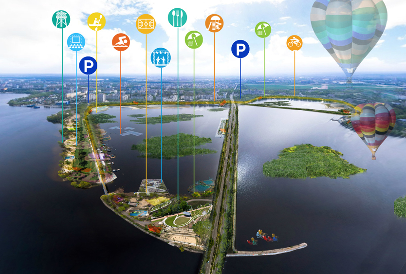
Aerial view of the “Leisure Island”, one of the proposals
The Department of Natural Resources and Ecology of the Voronezh region decided recently to organize a closed competition in order to develop a strategy for the future of the Voronezh Sea, a currently contaminated reservoir. The aim was to gather ideas on the use of the reservoir so it can be more attractive for the population and be a resource for the development of the city once the water is clean.
Today we are pleased to announce that our proposal has been awarded the first prize!

Click on the image to see some cool panoramas of the Voronezh Sea!
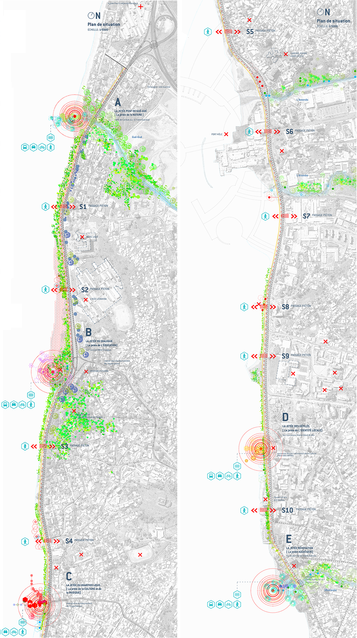
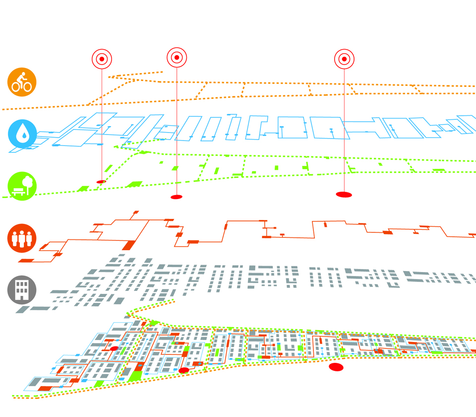
The proposal developed by Ecosistema Urbano after being selected for the second round of the competition works at different levels, addressing both the diverse sources of contamination and the potential uses of the existing reservoir. Our vision combines various solutions bringing new opportunities for leisure and activities for people to enjoy and experience the lake.
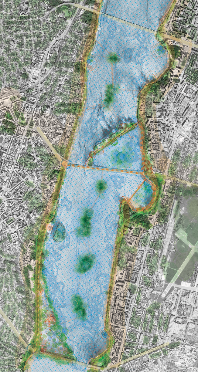
Our proposal
Addressing the different sources of pollution by providing customised solutions for each of them. These actions are framed as Phase 0. Among the actions we propose to place macrophytes on the surface of the water treatment plant tanks. This action can improve the performance of the Plant up to 40% and it is more efficient not only in the short term, but also in the long run as it reduces energy consumption and requires low maintenance.
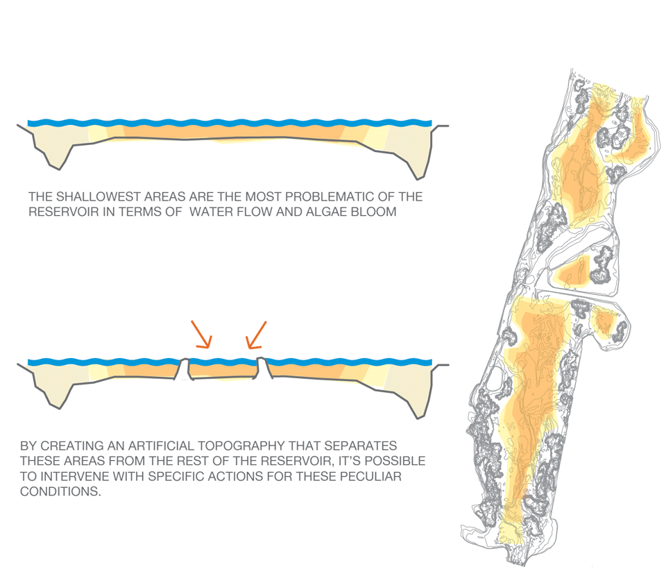
Working with floating macrophytes which can absorb many different contaminants. They would be located in the shallowest areas of the lake to stop algae from blooming and emitting a specific smell that comes from the reservoir in summer.
Floating macrophytes in action
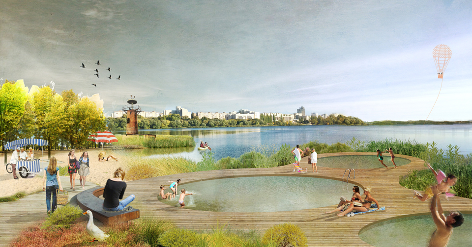
Creation of bathing areas both in the urban and at the natural environment of the lake, incorporating the macrophytes as part of the water purification system.
A series of floating mobile cleaning infrastructures. These barges help to control water eutrophication as it is important to reduce the amount of phosphorus. They have tanks filled with alum for phosphor sedimentation at the bottom and incorporate various leisure programs and possibilities on the top, so they can be used in different areas of the city during the summer season. At the same time, these floating barges include sampling and analysing systems so that real time information about the water conditions and quality is made available for everyone through the web platforms and mobile app, specifically developed for this purpose.
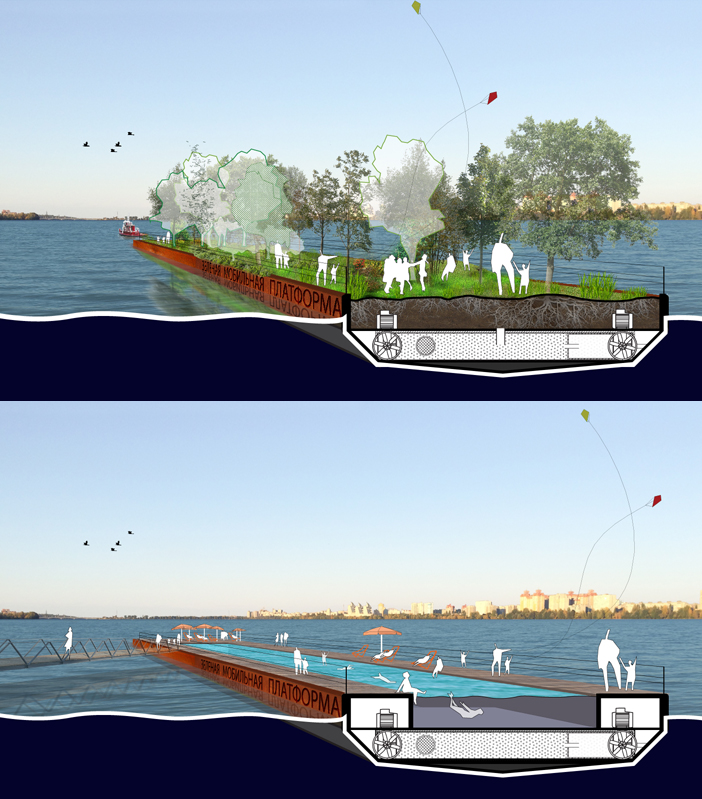
Floating mobile cleaning infrastructures
Two areas are proposed to be developed through Public-Private Partnership. These new developments will help to shape a new identity for Voronezh and a new relationship of the city with the water.
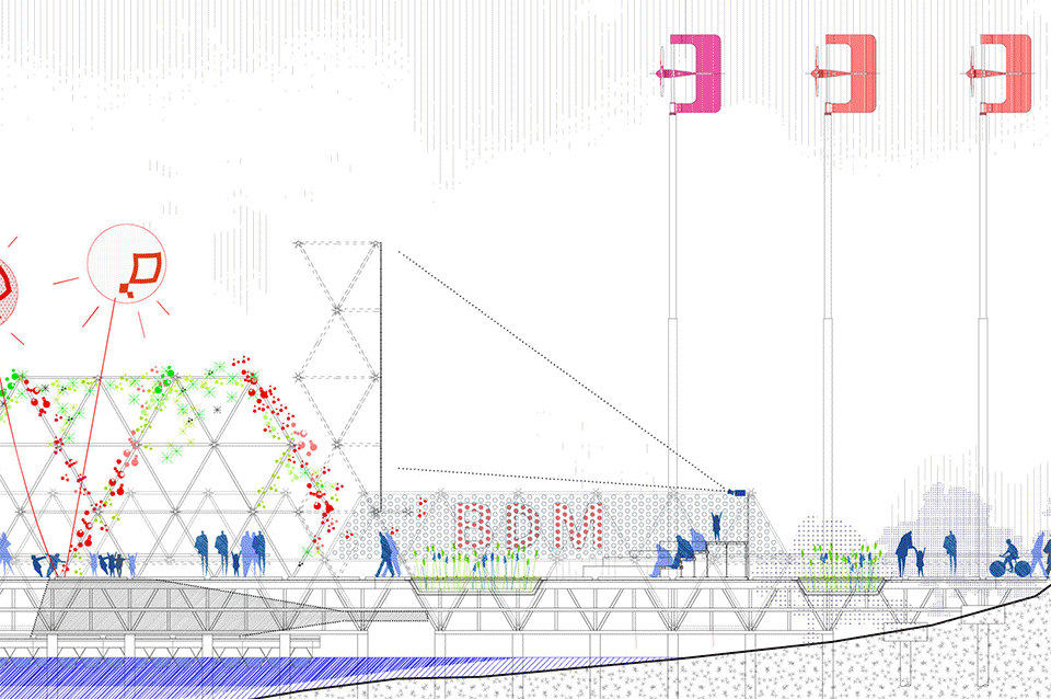
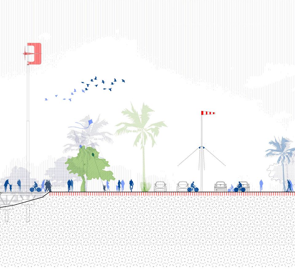
The first is a mixed-use zone including housing, offices, retail, public and cultural buildings etc. This new development must be a pilot experience incorporating all the current sustainable technologies, as well as incorporating good practices in water management. Rainwater and surface water runoff is collected and purified through small ponds with floating macrophytes for being used afterwards for irrigation. Pump system for ponds and aeration fountains receive energy from micro wind turbines located on the shore.
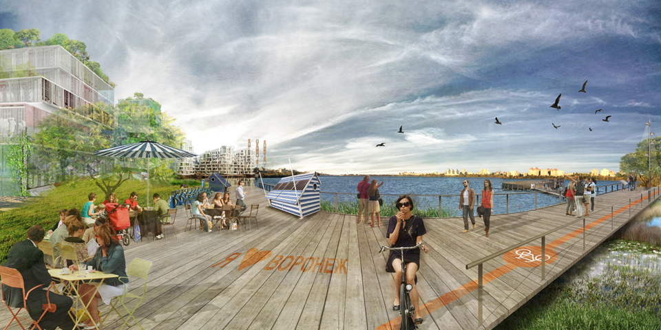
New development of a mixed-use zones at the lakefront
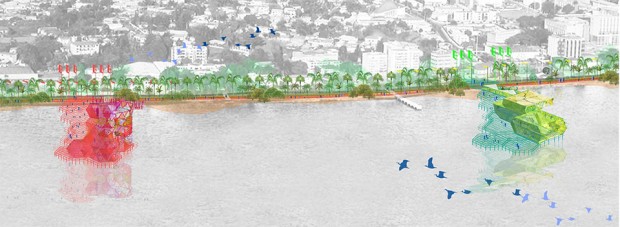
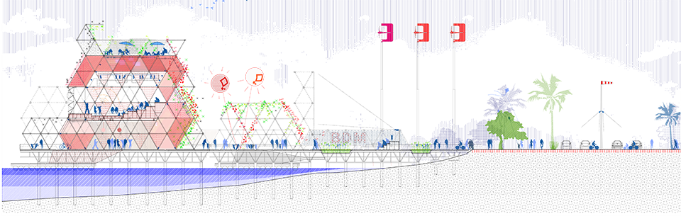
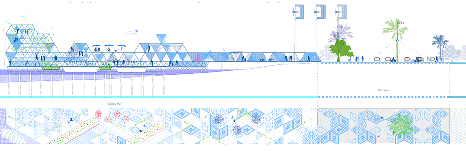
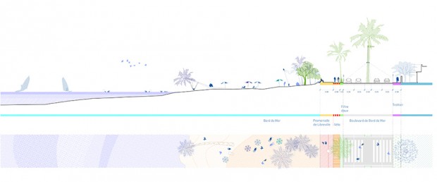
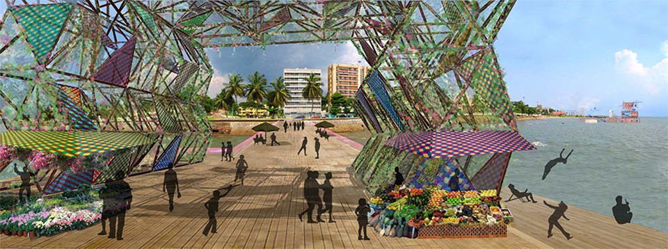
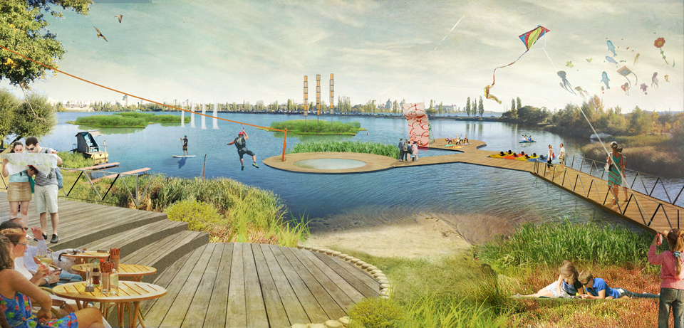
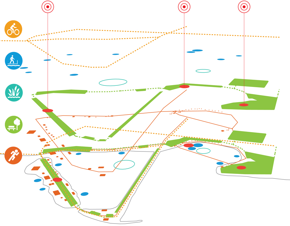
As a second development opportunity, ecosistema urbano proposes turning the existing Pridachenskaya dam into a Leisure Island with different activities, becoming a new infrastructure for the city incorporating clean water areas available for swimming and bathing. The island also includes bicycle and jogging paths, boat station for water-sports, urban beach, gardens and parks, playgrounds and sport facilities.
Typologies of cleaning and activity-hosting infrastructures
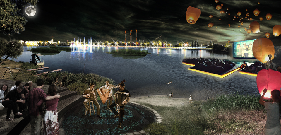
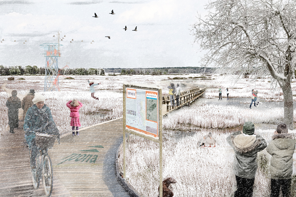
Next you can see some more images of the proposal, showing how water treatment and environmental regeneration could work together with social reactivation of the reservoir along the day and through the seasons.
Related links (in Russian):