Comment: (1)

Mass culture: How to not die of

Category: ⚐ EN+city+sustainability+urbanism

Last summer, different cities from different parts of the world screamed through their squares and streets, and the messages from their voices revealed more than what we could see at first sight.

2013 Taksim Gezi Park by Flashstorm

2013 Taksim Gezi Park by Flashstorm

In Turkey, protests clashed initially in Gezi Park in Istanbul, where the government wanted to impose a new shopping center in the middle of the city, where a green park stood. The protests appeared trivial and useless, as the decision to build another shopping center, commonly and always justified as part of innovation and development of a country, could not compete with citizens’ willingness to keep a green area in the city center. Anyway it appeared incredible that due to this occupation, government military forces started a real fight against the ‘riots’, so that from a little episode, the phenomena started to expand to the whole country, augmenting the size of the protest and people’s involvement.

Photo by Diren Gezi Parki on Facebook

Photo by Diren Gezi Parki on Facebook

Likewise, Brazilian people began to occupy their streets in the name of stopping their Government for what they considered a waste of money and resources: the forthcoming World Football Championship. As it is known, the investment for this is a huge cost, involving the building and the re-organization of new spaces. Citizens occupied the streets asking to invest that money in more urgent sectors, as education, health and security. For sure, behind this people movements, behind their complaints and their need of being listened to, there are several dimensions of a same problem.

The ‘problem’ is that people would like to be part of a democracy, as the Governments define themselves, and have access to a democratic life, having the chance to be active part of the decisions taken. Mass culture takes part as a dimension of the phenomena. We can try to understand why and to what extent.

The context for much of the current interest in material culture is a fear. It is a fear of objects supplanting people. That this is currently happening is the explicit contention of much of the debate over postmodernism which is one of the most fashionable approaches within contemporary social science. (Miller, 1998:169)

This statement is extracted from an article where the author explains that the fear described is an overrated feeling in sociology. If we consider the Marxist position, it uses to refer to a distinction between an assumed pre-era, far from material objects, and the modern one, made or dominated by material; anyway there is actually no evidence of this historical distinction from ethnography or past studies, as even old societies were rather engaged with cultural media (Miller, 1998). However, Miller’s thought is contextualized in a different discourse, whilst the theme, that hereby is going to be explored, touches that argument in the most ‘materialist’ way possible: Indeed it will be the consideration of mass culture intended in its symbolic and representative meaning, and especially in which way the symbolic and the representative are intertwined with the material objects and massive quantitative consequences of its use as media tools.

In this case, I would argue that fear is not overrated, rather it is underestimated. Indeed, fear is real as much as deaths due to climate change and revolutions; fear is real to the extent that some people have too much and others have nothing. In this essay mass culture will be discussed from the aspect of its weight on people and planet lives, in particular inside our cities. I would try to discuss mass culture from an ethic point, not asking if we are dominated or whether there is the domination of a Western or capitalist culture, but rather inquiring if we are dominated by mass culture without recognizing its cost in terms of social justice, sustainability and depleting resources, and thus, if we could change something before crashing indirectly also due to mass culture’s effects.

Mass culture and the city

Image by AlexandraGalvis

Image by AlexandraGalvis

Mass culture is, first of all, an incredible phenomenon itself. With this term, I will refer to the huge flowering of cultural products and cultural media that surrounds our daily life, often strongly driven by markets, and that, due to the global streaming, reach masses and are consumed quite globally. Thus, it is clear that within the phenomena, arts, events, shopping and most of the rituals and media we experience daily are directly involved. Above all, mass culture has a relation with the consumerism system and technology development. Furthermore, when we talk about mass culture, we talk about a collective culture production, and thus of a result due to human interaction. (Grazian, 2010).

It is not so difficult to imagine the particular relationship that mass culture engages with cities. Not just because it is possible to observe it directly, but because cities are primarily the first concentration of masses where people live into the network of relationships, where their lives are indeed organized and intertwined within the social system. Literature supports various different traditions and points of view: For sure the city has always been seen as a great place for commercial, business, capitalist trades and often cities have been built according to these interests. For instance, Marx Weber in his classic ‘The city’ (1958) discusses it in these terms, trying to identify their main features, stressing what defines a city and what is not enough:

Both in terms of what it would include and what it would exclude size alone can hardly be sufficient to define the city. Economically defined, the city is a settlement the inhabitants of which live primarily off trade and commerce rather than agriculture.

Certainly, due to chances of trades, relationships and exchanges, the city is the realm of business. Weber also considers citizens according to their consumer role:

Similar to the city of the prince, the inhabitants of which are economically dependent upon the purchasing power of noble households, are cities in which the purchasing power of the other larger consumers, such as reinters, determines the economic opportunities of resident tradesmen and merchants.

Moreover, he claimed that:

Thus, we wish to speak of a ‘city’ only in cases where local inhabitants satisfy an economically substantial part of their daily wants in the local market (…). In the meaning employed here the ‘city’ is a market place. The local market forms the economic center of the colony in which, due the specialization products, both the nonurban population and urbanites satisfy their wants for articles of trade and commerce. (1958)

So, as a central crossroads of activities made of relationships and exchange, soon the city became the symbol of economy, gathering around itself both producers and consumers, and creating for them a whole life, including mainly rituals and tools of innovation concerning demand/buying and offer/selling. This is well explained by Jayne in his essay ‘Cities and Consumption’ (2006). He conducts an analysis about the rising of the industrial revolution, mass production and the consequent mass consumption, and the rituals of shopping and entertainment that had developed around these, collocated in the spaces of the cities, according to class distinctions, social system and capitalist interests. And mainly it is from this process that mass culture developed for the most as we know it today. Jayne stresses also how the dominant class pictured the shape of cities basically operating on the re-organization of spaces in order to respond functionally to a social meaning of class division, but also to respond to new needs of rituals primed by economic growth and capitalist fuel (2006).

It is in the first years of the 20th Century that the consumption of objects as media tools of culture in a massive style starts to be established and spread, thanks to the incentive of mass commodification and the technology advances. As it has been described by Veblen (1899), and Bourdieu later (1984), consumption and possession became icons of status. Precisely, as affirmed with the concept of cultural capital, the consumption of a specific culture and lifestyle became the symbol of distinction within the capitalist societies, where agencies and institutions worked to perpetuate the status quo (Bourdieu, 1984).

A kind of economic frame-centrism seems to exist, indeed economy is often the most considered starting point for analyzing society, as an invasive factor that defines all that it touches. Anyway, according to me, it is necessary not to forget that economy is not the only working force, because, not considering the phenomenon exactly in its whole, we risk to fall into determinism, being partial, and not seeing alternative ways of operating.

Robert Park, the major exponent of Chicago School, in 1916 talks of the city from another point of view, in my opinion also changing the vision of mass culture related. I found his words extremely interesting:

The city, from the point of view of this paper, is something more than a congeries of individual men and of social conveniences-streets, buildings, electric lights, tramways, and telephones, etc.; something more also, than a mere constellation of institutions and administrative devices -courts, hospitals, schools, police, and civil functionaries of various sorts. The city is, rather, a state of mine, a body of customs and traditions, and of the organized attitudes and sentiments that inhere in these customs and are transmitted with this tradition. The city is not, in other words, merely a physical mechanism and an artificial construction. It is involved in the vital process of the people who compose it; it is a product of nature, and particularly of human nature. (1916)

Considering that, I would see mass culture more like something belonging to the city in a virtual and potential way, then created by people and by their relations built there, and as something that is not just derived by economic forces and consumerism traditions. Again, the city characteristics assume a more human look. Park doesn’t forget the economic side and recognizes its importance:

The city is not, however, merely a geographical and ecological unit; it is at the same time an economic unit. The economic organization of the city is based on the division of labor. (…) Much of what we ordinarily regard as the city-its charters, formal organization, buildings, street railways, and so forth-is, or seems to be, mere artifact. But these things in themselves are utilities, adventitious devices which become part of the living city only when, and in so far as, through use and wont they connect themselves, like a tool in the hand of man, with the vital forces resident in individuals and in the community.

Another last important aspect:

The fact is, however, that the city is rooted in the habits and customs of the people who inhabit it. The consequence is that the city possesses a moral as well as a physical organization, and these two mutually interact in characteristic ways to mold and modify each other… (1916)

Thus, the city is first of all the space of human action and the shape and personality of its citizens. It is the place where culture and ideas flourish, as a fruit of human interaction.

Image by Oleksandr Hnatenko

Image by Oleksandr Hnatenko, www.pohtography.com

Following this pattern, we can look at analysis that see the representative idea of a city today, as the core of creativity, the essence of innovation, and the development and growth of a contemporary era. The same Richard Florida best seller ‘The rise of creative class’ (2002) contributed to expand the idea of a different city representation. Together with the ‘The creative city’ by Landry (2000), the authors indicated culture in its whole manifestation as the best creativity booster factor to attract the main potential resource of innovation: creative people.

By the way:

Hall unfolds a very important aspect of urban creativity, i.e. the people involvement. In fact, in the view of many scholars concerned with popular culture, people are not only passively consuming goods, as ‘mass’, they are also creatively determining the production and circulation of culture (Chambers, 1986; Fiske, 1989a, b) and shaping accordingly their view of the city. (Botta, 2006)

Mass culture could be seen as created, influenced, inspired by and consumed in the cities. But, in a double way, the same city is protagonist of mass culture, of narrative and imaginary, recounted and repurposed as representative of an idea of the city itself.

Mass culture, consumption and sustainability

Once the interrelationship between city and mass culture has been observed and after having stressed how there is not an only way to intend this liaison, we could now focus on the weight of mass culture. This weight could seem invisible to most, in first place because they don’t want people to see it, and then because people don’t want to see it either. Indeed, I am talking of a complex plot process among mass culture, consumerism and mass consumption, something that concerns deeply our ‘normal’ representation of daily life, as the best life possible.

Every day we get up and go to work. We work to earn money and with that money we buy everything that can permit us to conduce a comfortable life, possibly happy, healthy and rich. The more we work, the more we earn, the more we want to have. Having objects, first of all, does not imply them to be stupid ones. We love design, we love to show off concern for our culture: So we fill our houses with books, compact discs, vinyls, vintage pieces, clothes, shoes, cars. We love of course an independent big house with all comforts, hot in winter and cool in summer. We love culture, we love style and good food, we love travelling around the world, we love a comfortable life, we love shopping. We love sports, we love concerts and dancing. And above all, we love doing everything in a single very amusing and cozy place: a big city that can offer this and more.

That above seems almost one of those pictures or statements that we can commonly find on the teenager’s timeline on Facebook. A real statement about ideal life underpinned by mass culture. Unfortunately it is a sad reality if observed under another point of view. I regret to communicate that our planet is not big nor rich enough (not anymore) to grant the same treatment to all the teenagers of the world. I am sorry to communicate to my friends that their passion to collect rock compact discs is increasing the garbage that someone else will probably find as plastic junk in the sea. I am sorry to communicate to citizens that our big cities are not going to be livable anymore if the presence of toxic gases will increase. I am sorry to communicate that while your favorite an-alcoholic drink brand, Coca Cola, launches its new advertise, assessing their will to help people and make the world a better place, with children singing in the background, in India their factories are exploiting the country’s water resources to produce their drink and the company is collaborating with Government to privatize the same water, taking it away from people.

Image seen in Global Environments & Societies wiki

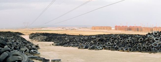
Image seen in globalenvironmentssocieties.wikispaces.com

It is not easy put in discussion the best lifestyle possible people’s idea: but it is time to really face the cost of our lifestyle, and our lovely mass culture. Maybe mass culture has become a natural part of our life that it is really difficult try to reason on it in terms of sustainability for the planet in which we live, the only one. This is because mass culture currently concerns almost all the rituals of our everyday life, including education, cultural capital, identity, wealth, traditions, and all the ‘soft’ symbolic part turned on rituals.

Anyway, at this point, it could be useful to make a distinction. For me, when we talk about mass culture we are not talking just and necessarily of consumerism, but perhaps more of rituals and activities that are deep-rooted within the consumerist society; this has then for sure been emphasized to an excess, in quantity and in stimulation and expansion of people’s needs. Indeed, Chandra Mukerji (1983) has historically described examples of consumer culture in the 15th Century Europe, where the exchange of media culture, such as books, exotic pieces from far places, jewels, spices and textures, was usual among royalty and upper classes (Wilk, 2002). Moreover, Peter Corrigan argues that the concept of ‘fashion’ was already well known in the Elizabethan times, when London was the center of trends (1997).

Today the modern consumption and the consumerism culture has achieved an exaggerate level of production of goods, if not waste. We could think that the human nature aims to have as much as possible or that being greedy is a natural component of human behavior; instead it is fairly reasonable that not in all societies, in the past nor now, people have the same need of possession, nor the same notion of richness or comforts. Nowadays, we can also say that not even the whole population belonging to the same society has the same notion of values in life and of our cities. Coming back for a moment to Turkey and Brazil, it is clear that a great number of people doesn’t agree with their Governments about which are the priorities for a good life in their cities. Could another shopping center create better conditions for people or enrich people more than a green space? Could a world event solve the social basic issues of inequity and poverty of a country? People are recognizing more and more that what is really important for their cities are adequate spaces for themselves, where they have the chance to choose their rituals or maybe to create them.

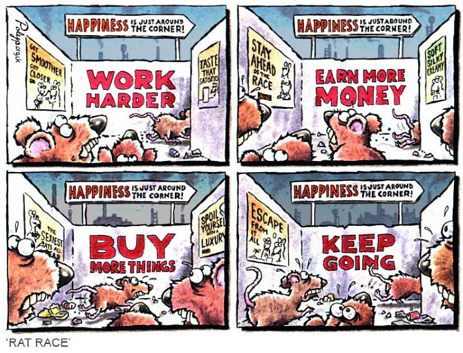
We are in a cyclic system that resembles a treadmill, where the whole society is involved, into the process of producing needs, old and new, and then producing goods. The index to indicate the level of wealth and growth is the GDP that measures the quantity of goods – products in one year per country. Is the huge quantity of goods produced seriously making our societies better and prosper?

Whereas mass culture (or mass cultures) is made of tools, symbols, icons, practices, rituals and it is something concerning people and their consumption in a certain way, what distinguishes pure consumerism today is: The quantity of goods produced; the stimulation and the expansion of needs; the pushing, by few stakeholders, of society towards consumption and possession. For sure marketing and selling strategies have always done a good job to lead practices, rituals and symbols around their products.

Buy More Stuff, Black Friday 2009 - Photo by Michael Holden

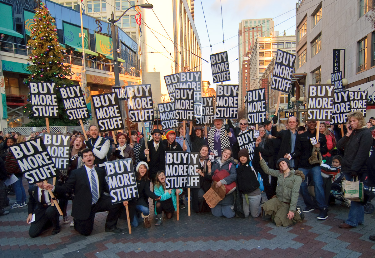
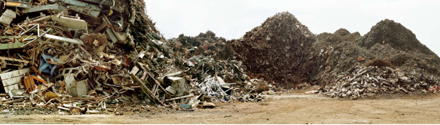
Buy More Stuff, Black Friday 2009 – Photo by Michael Holden

Consumerism affects mass culture so much that is primarily a mean of identity and interaction with others, because historically our Western capitalist societies consider money and the quantity of goods as distinctive symbols of wealth and success in life. Sure is that, the existence and the use of mass culture both suffer this deal. But in a society where we are conscious of the issues concerning the exploitation of resources and the return of it under the shape of garbage and where the first value is keeping safe life conditions, mass culture could change look. Already now we are adhering to style trends for smart cities, car sharing, waste recycle and other practices, that if inserted as pieces of mass culture into our lives could help to change mass culture too.

Thus, we cannot just criticize our consumerism society in terms of the damage that we are causing. We should start to reflect on our daily cultural practices, which are indeed made of mass cultural media tools, starting by city spaces, where our activities are concentrated and where more than other we could see the rituals and the proliferation of mass culture. And thus, we should begin thinking of a new approach based on them. I am persuaded that we could indeed change mass culture through mass culture itself.

According to the anthropologist Margaret Mead, there is no single approach working successfully in every society; rather, each one has a “culturally appropriate” approach, concerning the specific characteristics of its individuals (1953). In this perspective, Wilk argues:

They imply that no single set of solutions, technological, legislative, or cultural, is going to work in every society. On the contrary, we should expect great diversity in the ways different countries and cultures deal with sustainability problems. How can we expect things to change in the countries that presently consume so much more than their share of global resources? (2002)

When we talk about cities, we then talk about mass culture too, thus maybe cities could live by a different mass culture. As the city has been the protagonist of growth of mass society and mass culture of consumerism, it could also happen that the city may see the birth of a new and fairer society. Indeed, change should begin from here, from the set of organizations and citizens, in creating different rituals and use of the spaces.
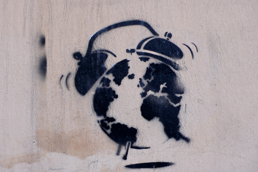
Image by Starkart

Image by Starkart

Bibliography:

Bourdieu, Pierre. 1984. Distinction: a Social Critique of the Judgment of Taste, trans. Richard Nice. Harvard University Press.
Corrigan, Peter. 1997. The Sociology of Consumption: An Introduction. London: Sage.
Florida, Richard. 2002. The Rise of the Creative Class. New York: Basic Books.
Grazian, David. 2010. Mix It Up: Popular Culture, Mass Media, and Society. New York: W. W. Norton & Co.
Jayne, Mark. 2006. Cities and Consumption. New York: Routledge.
Landry, Charles. 2000. The creative city. New York: Routledge.
Mead, Margaret; World Federation for Mental Health. 1953. Cultural patterns and technical change. Ann Arbor: University of Michigan Press.
Miller, Daniel. 1998. “Coca Cola: A Sweet Black Drink from Trinidad.” Pp. 169-187 in Material Cultures: Why Some Things Matter, edited by D. Miller. London: UCL Press.
Mukerji, Chandra.1983. From Graven Images: Patterns of Modern Materialism New York: Columbia University Press.
Park, Robert. 1916. “The city: suggestions for the investigation of human behavior in the urban environment” Pp. 90 -130 in Classic Essay on the Culture of Cities. New York. 1969, edited by R. Sennett. New York Appleton-Century-Crofts.
Weber, Max. 1958. “The City.” Pp. 23-46 in Classic Essay on the Culture of Cities. New York. 1969, edited by R. Sennett. New York Appleton-Century-Crofts.
Wilk, Richard. 2002. “Culture and Energy Consumption” Pp. 109-130, in Energy: Science, Policy and the Pursuit of Sustainability, edited by Robert Bent, Lloyd Orr, and Randall Baker. Island Press: Washington.
Veblen, Thorstein. 1899 [1973]. The Theory of the Leisure Class. Introduction John Kenneth Galbraith. Boston, MA: Houghton Mifflin.

This is a guest article by Simona Ibba (@PenniLeyn). Thanks, Simona!

If you want to get your own article published, see this.
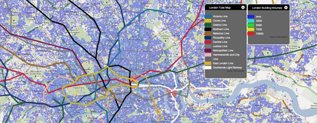
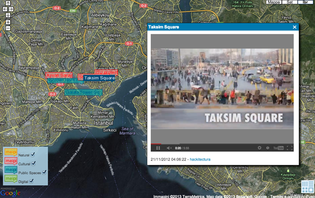
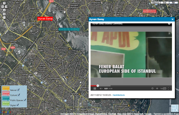
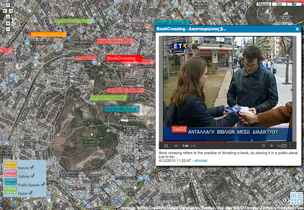
Comment: (1)

MetaMap | MapTube by CASA

Category: ⚐ EN+city+internet+MetaMap+technologies+the environment

MapTube Homepage

Today I present the interview with Richard Milton, member of the research staff at the (CASA), a unit at the Bartlett Faculty of the Built Environment (The Bartlett).

CASA’s focus is to be at the forefront of what is one of the grand challenges of 21st Century science: to build a science of cities from a multidisciplinary base, drawing on cutting edge methods, and ideas in modeling, complexity, visualization and computation. Our current mix of architects, geographers, mathematicians, physicists, archeologists and computer scientists make CASA a unique department within UCL.

His current position in the centre is described as the following:

Richard is a Senior Research Associate currently working on the ESRC funded TALISMAN project, having previously worked on GeoVUE and GENeSIS. He is the key developer in these projects, being responsible for the e-infrastructure developed in GENeSIS and GeoVUE, which is currently used for real-time web-based geospatial data visualization. This infrastructure is currently used in the MapTube, SurveyMapper and Gemma websites.

MapTube is a free web resource for viewing, sharing, mixing and mashing maps online. The main principle of MapTube is that shared maps can be overlayed to compare data visually. For example, you can view a map of the London Underground overlayed with a map of building volumes to get a new perspective of the city.

Overlay of London tube map and London building volumes

1. How did you get to the practice of mapping?

I originally got into mapping by working on weather visualization systems for the UK Meteorological Office. After that, I worked on a project in UCL on GPS-tracked carbon monoxide sensors, displaying the data through both 2D and 3D views of the city. Then, I started working for CASA, developing the GMapCreator software, allowing people to create Google Maps from the data stored in shapefiles, which led to the MapTube website.

2. In what way do you obtain and treat the data for your mapping?

I often have to do a lot of pre-processing of the data before it can be mapped, but on an ad-hoc basis. The real-time data is also quite challenging as there are often errors in the data that have to be cleaned and the pre-processing for the London Underground, National Rail, and Bus data are quite involved. The data is sampled on a 3 minute basis, so all processing needs to happen very quickly.

Global McDonald’s Big mac prices, 2007

3. What is the application of the open source mapping you are interested in the most?

I think the amount of data that’s now in the public domain is the greatest interest. We are getting to the point where we are being swamped with data and need to look for methods to handle much larger quantities than before.

4. What is the next phase of development your research is undergoing?

The next phase of development is very hard to quantify. We’re looking into various things like BigData, Real-time data and DataMining.

5. What are you personal references about the theme of mapping (from ancient to contemporary ones)?

My interests are really in automatic mapping, from data and how you handle it from multiple sources (data fusion) to visualizing complex situations.

England grade of land use

This is the last post (for now!) in our MetaMap series about mapping. You can follow the conversation in your favourite social network through the #metamap hashtag.


Comments: (0)

MetaMap | Pablo de Soto

Category: ⚐ EN+architecture+city+landscape+MetaMap+technologies+urbanism+video

Pablo de Soto is part of the generation who lived and experimented with the creative explosion generated by the web. His studies in architecture have enabled him to look at digital culture through a unique perspective. Keeping as reference, science fiction, situationism, and hacker ethic.

In 2001, he founded hackitectura.net, along with José Pérez de Lama and Sergio Moreno Páez, and a crew of architects, programmers, artists, and activists that participated in projects that dealt with themes of cartography and mapping. I interviewed Pablo de Soto about Sevilla Global, Cartografía Crítica del Estrecho de Gibraltar, and Mapping the Commons (Istanbul and Athens)

Here are a few screenshots of the maps:

Taksim Square, Istanbul

Fener Balat, Istanbul

Brook Crossing, Athens

This post is part of the MetaMap series about mapping. You can follow the conversation on your favourite social network through the #metamap hashtag.

Comments: (0)

MetaMap | 6000 km by Basurama, interview with Pablo Rey

Category: ⚐ EN+city+internet+Intervista+landscape+MetaMap+urbanism

Basurama is a forum for discussion and reflection on trash, waste, and reuse in all its formats and possible meanings. It was born in the Madrid School of Architecture (ETSAM) in 2001, and since then, has evolved and acquired new shapes.

Tire Cemetery in Seseña (Toledo)

I interviewed Pablo Rey Mazón, member of Basurama, about 6000km, a project about the concept of trash applied to new constructions and land use, the metabolism of the city.


1. How did you get to the practice of mapping? What led you to the practice of mapping?

We use mapping, a geo-spatial representation of things, to understand and display complex situations. Maps have always been interesting to me: subway maps, the Callejero (the streetmap book from Madrid), and later in architecture school, I was using and producing maps quite often. Google Maps and Google Earth came later…. maps are one special part of all the data visualizations tools available.
I have also participated in the development of meipi.org, an open source software for collective geo-location of information (texts, photos, videos, and audio) online, that we have used in many projects.

Interface of the map - Click to see original at Meipi

Interface of the map – Click to see original at Meipi

2. How did you choose the object of your mapping?

A map is a tool to decode certain information. Depending on the project, we would use one visualization or another. When we’re interested in the location of things, we use maps. In Basurama, we’ve used maps for many different projects apart from 6000km:

-Mapping urban metabolism landscapes (panorama photos) + real estate bubble: map, tactics in 6000km

-Mapping reusable waste in Ruhr (Germany) map 1map 2how to

Flow of waste in Mexico City

Exchange of objects map

In Ruhr, we used geo-located photos that we took, and a special instance of Meipi, to show the location of possible reusable waste. In spermola.org, we tried to give the opportunity to exchange an object by providing information about where the object was.

6000km started as an exhibition of 10 big format panorama photos from the Madrid outskirts: landfills, highways, scrapyards, and abandoned places. The project was part of the exhibition and was named Basurama Panorámica. It shows the public different places to envision the consequences of the urban expansion that was occurring at the time. Each photo had a short text attached to it, that served to contextualize and give basic information about it. We didn’t just want ‘awesome’ photos, we wanted to make people understand where and what those locations were. The exhibition had two related maps: urban growth and highways, apart from a location map of all the photographs. Displaying urban developments together with landfills and empty toll highways was the way to show the relation among all the urban metabolism related situations. Empty buildings made for speculation purposes where as waste made for scrapyards. That was 2006, 2 years before Lehman Brothers declared bankruptcy.

Later on, when we addressed this project in a country scale we studied and mapped all the situations in 6000km.org. “6.000 km” were the kilometers of highway that the government was planning to build until 2020.

Mar Menor Golf Resort – Torre Pacheco, Murcia

3. In which way do you want this work to affect the people and society?

It is difficult to say how a particular project modifies the perception of a situation. In 2006 the real estate bubble was about to burst, but the public perception was saying “prices are never going to drop”, “we are the biggest growing economy in the world”, “keep building, buying, and selling, make money”. Mass media and politicians were basically denying the real estate bubble or saying that the process of land destruction was not sustainable. It was uncommon to address this topic. Nowadays, we can watch and read multiple news, documentaries, and exhibitions about a contemporary ruin or the economic crisis, but that was not the case back in 2006. It is impossible to measure that impact.

However, we were not alone in this task. There were other people talking about these issues as well. An example, El tsunami urbanizador español y mundial from the late Ramón Fernández Durán, or Ramón López de Lucio, that used our exhibition, among other things, to talk about the urban expansion and the backdrops of the star system architecture.  A year later, the Observatorio Metropolitano published a complete study of Madrid that delved deeply in the economical, social, and urban aspect of the situation. Madrid ¿La suma de todos? Globalización, territorio, desigualdad, and Derivart published casastristes.org.

Junkyard Hermanos Lopez – Parla, Madrid

4. Which is the next phase of growth/development your research is undergoing?

We went from the regional scale, Madrid conurbation, to a country scale, Spain, in 6.000km. We created an online map at meipi.org/6000km to display how our research evolved and to open both the information and participation to the public. We went to many of those places to document the sites. We have a full list available of all the studied locations, as we have realized before in Meipi, that maps are not the only way to show spatial information, and that lists can also be very useful.
Global scale: Since we’ve been travelling often to America with Basurama in the last years, we are now exploring ways to talk about these situations on a global scale in PAN AM, Panorama Americana.

Ruins in Vallecas, Madrid  - Click to view original map

Ruins in Vallecas, Madrid – Click to view original map

Photos from the sky: We are also exploring new ways of exploring the territory with cheap balloon mapping technology. Our first results from Spain could be seen in the ruins at PAU del ensanche de Vallecas. Since last year we’ve been collaborating with the Public Laboratory in Boston, where we are mapping the evolution of an ash landfill in the suburbs of the city, Incinerator Landfill in Saugus, MA, USA, as well as mapping the waste locations from Cambridge, MA.
Civic maps: I am involved in a tool kit about civic mapping that will be released this year by the Center for Civic Media.

Alto del Cuco – Pielagos, Cantabria

5. What are your personal references for the theme of mapping (from ancient to contemporary ones)?

References come from many places: data visualization researchers like Edward Tufte; open hardware and cheap tools by Public Laboratory; Ushahidi and Crowdmap for collective info about maps; vojo.co for collective reporting from cheap phones; and online cartography tools like OpenStreetMap, where we are contributors and try to draw landfills and other non represented places in the map.

All the photos of the article are under a Creative Commons Attribution 3.0 Unported License and are made by Rubén Lorenzo Montero and Pablo Rey Mazón (Basurama). See legal notice.

Comments: (0)

MetaMap | [im]possible living, rethinking the abandoned world

Category: ⚐ EN+city+internet+Intervista+MetaMap+technologies+urbanism

[im]possible living is a crowd-sourcing website dedicated to mapping and reactivating abandoned buildings around the world.

[im]possible living wants to be an enabler and a catalyst of the energies available in every place in the world that are not able to get through and give birth due to the abandonment market and, in general, to a new housing development model. It’s a very ambitious goal, but we truly believe in it and are investing everything in this dream!

I interviewed the two founders, Daniela Galvani and Andrea Sesta, about the project.

[im]possible living

1. How did you get to the practice of mapping? 

[im]possible living is born from our personal interest in abandoned buildings. At the time we understood that many individuals and associations were spreading energies to map the abandoned buildings in their area, but everyone was doing their own maps, thus losing the possibility of sharing results, experiences, and the best possible practices.

So we decided to create a global map of abandoned buildings via a web platform, where everyone could participate and contribute to a common goal and benefit from the experiences of other people.
Since the beginning of the project we have gone far beyond mapping tools. With the last release of our site, people can now reactivate an abandoned building and involve the community in the design concept for the new life of the building.

2. How is the users’ contribution managed? How does the platform work?

The website consists of a service through which users can surf and see the abandoned buildings that have been mapped around the world, which also shows their profile, containing a general description and some detailed information about the building (year of construction, years of abandonment, square meters, number of floors, etc.) To explore the mapped buildings click here.

The real heart of the service, however, is the reporting and collaboration features, through which users can upload new abandoned buildings and enrich existing records by adding photos and videos. If you would like to begin a map click here.

Users can also use a mobile app for the iPhone to instantly map abandoned buildings. Once launched, the application allows you to choose a photo from the Pictures archive, add essential information and automatically provide the geographic data associated with the location (street, city, etc.), allowing the user to change any incorrect information.

The last new part, which has launched recently, allows users to start a reactivation process. Once an abandoned building is mapped, a user can decide to become the reactivator of the place and [im]possible living provides him/her with a suit of services that helps collect the needs of the area, ideas for the future of the building, and in general, create a community that supports the reactivator in designing a concept for the new life of the building. The platform also tries to connect different kinds of users, everyone possibly involved in the renovation process: citizens, entrepreneurs, professionals, artists, real estate developers, etc.

[im]possible living map

[im]possible living map

These services are now online and we already have some projects running that you can contribute to or simply surf to get an idea:

Padiglione Conolly by RETESPAZZI
Sottopassaggio pedonale di Porta Vescovo by AGILE
Edificio 3 by workinco
Residenza by LANGYX
Villa Olga by BIELLAINMENTE
Ex Casa albergo per anziani by SIMONACOLUCCI
Ex-macello comunale by ASSBUENAONDA
Ex-Ospedale San Giacomo by ASSBUENAONDA
Masseria O’ Sentino by INDIEVIDUI
Stabile di uffici abbandonato by DANYGALVANI
Palazzo Cosentini by CARLONATOLI

3. What is the process you wanted to start with your work? What is the social aim you wanted to reach with your work?

In the last years we have witnessed the constant investment in new construction, leaving behind millions of old abandoned buildings. This process has led to the phenomenon of land consumption in most of the world, but the recent economic crisis stressed the problem even more, condemning the new constructions to remain vacant.

The solution to this problem is taking an altogether new approach: abandoned buildings are not liabilities but assets from which we should take the most possible advantage. [im]possible living tries to promote this new sustainability approach. Instead of building new structures over and over again, we can utilize what already exists. Having abandoned buildings in your city or in your neighborhoods is not only a waste, but it also means trouble, that, in a long term perspective, becomes costly for the public sector.

We are creating a platform available to all, which consists of the most complete database of abandoned buildings in the world. It is a virtual place that everyone can use and all can be shared and discussed, and where citizens can actually have an influence in shaping the future of the place they live in.

Many times the interests of construction companies, or even publicadministrations, are not consistent with the local environment of the area itself. This missing link between those sides can be discussed through the [im]possible living platform, in order to build mutual benefits for both sides. Through the website, entire communities can share their needs and ideas, and this could lead to a win-win situation for all parties involved.

Nowadays, real estate projects are handled behind closed doors and the problem is that often the local population is not involved in the design process. This implies, on the one hand, a mismatch between the purpose of the construction project and the real needs of the urban and social settlement. On the other hand, it takes additional time to complete due to the resistance from local communities, which often brings in legal involvement.

Our aim is to create a more efficient process to reuse abandoned structures, with a benefit for local communities that will be able to affect or even contribute projects on the online platform. A benefit for the public and private investors that would receive important inputs or even entire concepts developed by teams of reactivators and a benefit for the reactivator teams that would pursue their own projects with all the technological, professional, and financial support to fully accomplish their goal.

4. What is the next phase of development that your research will undergo?

We released the reactivation services a few months ago, so now our aim is to expand the community as much as possible and start as many reactivation projects as possible. This is very connected to making the available services better, making the actions easier, making the contributions from the community as simple as possible, and adding new features that can increase the sharing activity on the site.

Furthermore, we want to investigate the real bottleneck of reactivation processes: getting the project funded! In fact, the real problem when you talk about abandoned buildings is that, even with low-cost interventions, using them involves pricey investments. So our question is: How do we ease the investment process? How can we push for better projects and actually bring them to life? It’s complicated research, but it’s definitely what we want to focus on during the next year.

5. What are you personal references for the theme of mapping (from ancient to contemporary ones)?

Our point of view is very connected to recent technologies, in particular, web technologies. We consider the birth of web 2.0 and web 3.0 the beginning of a new era: the shift from static contents to dynamic ones, but more importantly, the participation and involvement of people in crowd projects, tools created for geo-localization, augmented reality, and much more.

This had a dramatic impact on the theme of mapping: for the first time in history, people from around the world could contribute to global mapping projects seamlessly, using services like Google Maps, Open Street Map, Wikimapia, History Pin, Ushaidi, Foursquare, and thousands of other services that are enabling users to map things in the world and share the information globally.

This process is generating a huge amount of data that, in most cases, is openly available to everyone via API systems (in computer science, an API is a way to access private databases, retrieve information, and build a new service using one or many different external data sources) For example, today I can use Google Maps API to obtain geographical information and then use Wikipedia to map monuments and historical places.

The potential of this revolution is very immense and has already started to affect our society in a significant way, but we still can’t entirely understand all the possibilities that will be generated in the upcoming decades.

Site: [im]possibleliving
If you would like to know more, visit their BlogFacebook and Twitter, or read their FAQ

Comments: (2)

MetaMap | Urban Sensing by Accurat

Category: ⚐ EN+city+internet+Intervista+MetaMap+technologies+urbanism

Accurat is an information design agency based in Milan and New York, founded by Giorgia Lupi, Simone Quadri and Gabriele Rossi in 2011.

They define their work as the following:

We envision and identify new ways to structure information, revealing and addressing latent needs, desires and opportunities. Basing our methods on the design thinking approach, we specialize in providing our clients with consultancies, services, and products related to information design. Focusing on how information is transforming networks, cultures, contexts, and behaviors is an attempt to understand the future, a demonstration that it can be intercepted and designed.

I interviewed them about Big Data base maps and about their ongoing work in mapping: Urban Sensing.

Experiment of Tweet mapping in Milan during design week


1. How did you get to the practice of mapping? 

To us, mapping could be seen in a broader context as “structuring information”.

To start off, it’s not needed to say that information related issues are at the core of any design project that deal with cities, public services, society, and behaviors regardless of scale. Particularly, we have always been interested in urban related projects that deeply rely on information: contexts, analyzing data, designing analytical tools, and visual narratives that provide awareness and comprehension of changing urban dynamics.

In our past entrepreneurial experiences, at Interactiondesign-Lab, we experimented working between the intersection of information systems and urban dynamics within the design of the Plan of Services for the Municipality of Milan (developed between 2009 and 2010). We designed a plan not to be intended as a product or document, since it was developed as a continuous process of listening, monitoring, reporting, and crossing the needs and the offers in terms of services of the city.

We designed 2 tools at 2 different scales, the macro scale of the city and the micro scale of the neighborhood. These tools don’t define what services we plan to have, but they give directions on how to cross the demand and the possible answer in terms of services in a meaningful way. It was, in fact, an information design project.

2. In what way do you obtain and treat the data for your mapping?

A big mapping project we are currently working on and coordinating at Accurat is ✳UrbanSensing.

The ✳UrbanSensing project is a EU funded project which aims to design and develop a platform for extracting patterns of use and citizens’ concerns with city spaces, through robust analysis of User Generated Content (UGC) shared by city users over social networks and digital media. The platform will allow the user to analyze citizen’s perceptions related to specific geographic areas and understand how population reacts to new urban policies within participatory mechanisms.

Novel digital and telecommunication technologies can be deployed to integrate data-sharing platforms within the spatial dynamics of the city. If properly analyzed, geo-tagged and User Generated Content (UGC) coming from Twitter, Facebook, Foursquare, or Flickr can be useful in the creation of meaningful, real time indicators of people’s perceived and communicated urban experiences. Through natural language and network analysis, it is possible to identify the nested micro-narratives that shape the behavioral and semantic background of a place and to extract specific urban indicators.

Our assumption is that by conducting an analysis of datasets based on text extracted from UGC we can recognize multiple stories, as they emerge, overlap and influence each other, unfolding from city users’ mental representations and spatial experiences of city spaces. In fact, by providing tangible, visible references, the spaces of actual buildings and cities participate in constructing the meaning of the speech that articulates itself within them and as conversations unfold within particular architectural settings, they build up increasingly dense webs of shared understanding grounded -at least in part- on the points of reference that these settings afford.

Thus, within ✳UrbanSensing we are mainly gathering and analyzing geo-localized social media data (Twitter, Foursquare, Instagram, and Flickr); and such data will be properly integrated and compared with more traditional sources of urban information (socio-demographic territorial data, real-estate indicators, and environmental data) to produce dynamic and evolving images of the city as used and perceived by its’ citizens and temporary users.

3. What is the application of open source/social network-based mapping you are interested in the most?

If properly analyzed, integrated, and interpreted, Social Media data can help stakeholders at the urban scale to “forward-looking” innovation strategies based on a thorough analysis of people’s contexts, interests, and needs.

Among the possible urban topics this data could partially answer to, we will narrow them to the following particular issues:

  • Rapidly intercepting emerging urban dynamics, such as gentrification processes and precise areas’ evolution through time (for identifying trends in areas’ related phenomena, in the exact moments they’re originated, with the possibility to add more dynamic parameters to those used by the real estate market);
  • Understanding which are the factors (e.g. morphological aspect, aesthetic quality, public service availability and density, infrastructure granularity, cultural scene, and commercial service) that attract people in particular places (areas, neighborhoods), and how this evolves through time;
  • Understanding which kind of people (language / on-line influence / demographics) are in specific areas at particular moments;
  • Highlighting patterns of movement throughout  the city (from which places people in an area come from? where are they going? are they residents, visitors, or ordinary city users?);
  • Interrogating data about a particular topic (e.g. brand name, event name) or about a selected theme (e.g. cultural phenomena, cutting-edge topics) to see how things evolve spatially and temporarily.

All this, to provide a better understanding of an areas’ related phenomena and evolution, to redefine actual districts’ fixed boundaries and to see where public services, policy’s infrastructures, design interventions, or activities could be better located, and to try and build models to predict near-future evolution;

Experiment of Tweet mapping in New York


4. What is the next phase of development that your research is undergoing?

One of the forthcoming steps of our project is to gain a deeper understanding of:

  • How such data sources could be interpreted (in terms of sharing behaviors and motivations) to get actual and consistent insights;
  • Which are the real limits of such data in terms of research (e.g. demographic, digital divide, economic, location-related);
  • How to overlap and integrate such data sources with more traditional layers of territorial information (e.g. socio-demographic data, income data, rental costs, ethnic data, and environmental ones such as pollution and sanitary inspections, etc.) to finally display extreme high-resolution views and interpretations of territorial related dynamics.
  • How unexpected patterns and meaningful questions could emerge from data themselves. 

In fact, UGC differs from conventionally produced geographic information in several aspects. The source of the information, the technologies for acquiring it, the methods and techniques for working with it, and the social processes that mediate its creation and impact. Traditionally, geographic information has been produced by experts and institutions, therefore, certain types of information have been privileged and other types ignored, and even marginalized. UGC’s represent a powerful shift in sources, content, characteristics, modes of data production, mining, sharing, dissemination, and use. Therefore, a wide set of meaningful questions (that have been partly investigated for “conventional” geographical information) need now to be re-investigated, and a framework on how to use these information still has to be built.

In parallel, we are designing and developing the technological architecture and the actual interface allowing us (and lately, stakeholders) to perform specific queries and produce such dynamic maps in a very visual and intuitive way.

5.  What are you personal references for the theme of mapping (from ancient to contemporary ones)?

We would here focus on emerging critical practices that propose new models to describe the city that stresses the collaborative and constructionist dynamics of the mapping process.

The underlying idea of this approach considers the geographic, urban experience through a network of multiple fragmented temporary data and information generated by human-place interactions and collaborative dynamics. Based on these theoretical premises, several experimental GIS-based applications focusing on cartography emerging from users’ perceptions and activities have been produced.

As Zook & Graham noticed, traditional methods used to register users’ perceptions and activities about the cities and its fruition – like surveys and ethnographic reports – seem to be inadequate to meet the need of information of contemporary society both because they require a considerable amount of resources (in terms of time and money) and because they do not consider the temporal dimension.

Mapping projects based on UGC have been therefore conducted both by research institutions (e.g. CASA at University College London, SIDL Lab at Columbia University, Senseable City Lab at Massachusetts Institute of Technology, Urban Age at London School of Economics) and independent scholars and design firms (e.g. Christian Nold, Stamen Design) with the aim of creating new ways to observe and depict specific subjective and objective processes taking place in cities.

Senseable City Lab explored mapping systems based on UGC on several projects like World’s Eyes and Obama One People.

Current City, a European foundation committed to address long-standing city management problems in unconventional ways, explored the potential of urban mapping based on real-time data streams on users’ location coming from telco providers.

Christian Nold’s work focused on in-depth research of technological tools in order to unravel their social and political layers, and on building socially constructive, bottom-up devices, that take the form of practical tools such as in the Bio Mapping project.

Bio Mapping is a research project based on biometric sensors that can be worn by users provided with a GPS device able to trace their paths through the city, and that register specific parameters (e.g. emotional status in a specific place or situation) and publish them as user generated content on specific emotional maps. This project explores tools that allow people to selectively share and interpret their own bio data. Within this framework, Nold investigates how the perceptions of a community in an environment can change when they become aware of their own intimate emotional status.

Some other recent GIS projects focused on the idea of building open tool-kits that could be used by the community of students and practitioners of urban design, planning, and management. The Centre for Advanced Spatial Analysis at UCL created MapTube as a free resource for viewing, sharing, mixing, and mashing maps online and the NeISS project (National e-Infrastructure for Social Simulation) provides a platform to meet the demand for powerful simulation tools by social scientists and public and private sector policymakers. The tools enable researchers to create workflows to run their own simulations, visualize and analyse results, and publish them for future discovery, sharing, and re-use. This facilitates development and sharing of social simulation resources within the urban planners and social science community, encourages cooperation between model developers and researchers, and helps foster adoption of simulation as a research method and as a decision support tool in the public and private sectors. Design Tool is an application proposed by Predrag Šiđani, which has its starting point in Lynch’s propositions about city and urban form. Lynch’s theory of urban form and its hierarchical structure of main urban elements were applied, together with his concept of cognitive mapping, to a conceptual model of the Design Tool.

This is the second post in the MetaMap series about mapping. You can follow the conversation on Twitter, Google+, Diaspora, or Facebook through the #metamap hashtag.

credits: Giorgia Lupi and Gabriele Rossi (accurat.it)
acknowledgements: texts above are part of the UrbanSensing project
Design Week Tweets: Accurat with Marco Vettorello (data gathering) and Paolo Patelli (data processing and visualization)
Thanksgiving: Accurat with Marco Vettorello (data gathering and processing)

Comment: (1)

MetaMap | a web research on mapping

Category: ⚐ EN+city+internet+MetaMap+open culture+technologies+urbanism

Image by Tommaso Miti for Ecosistema UrbanoMaps and cartography have been, traditionally, tools to express and exercise power and have been used exclusively by a few people who held the knowledge. Nowadays, this practice is enriched by more and more nuances and gets contributions from all sorts of fields.

We find maps exposed in galleries, painted in the streets, and drawn as acts of performance art, dealing with the necessity to express identities and culture in mass societies. We see maps based on a huge amount of information and real time data coming from social networks, which were only made possible once computer science and the web appeared, thus enabling us to have an unprecedented knowledge of what’s happening in cities. Cartography is even used as a tool to emphasize critical aspects of our society that, otherwise, wouldn’t be noticed and as a platform to solve these same problems.

All of these multiple approaches are becoming a common experience as they are often the result of a participative process and are shared as open source information. On one side, this shows the need of understanding the growing complexity of reality and the quantity of information that is being produced. On the other side, it expresses the need to re-create an identity through self-knowledge in the actual context of globalization.

I have decided to examine the current state of cartography due to the influence it’s having on many fields today, with the power to be transversal with the classical arts. This research is an ideal continuity with the exhibition that was recently hosted by Caixa Forum (Madrid), on contemporary cartographies. The exhibition started with the situationist and surrealist approaches that opened up the mapping discipline, introducing contaminations from other fields (art, politics, statistic…) overcoming the scientific point of view, showing it lacks the description of reality.

The aim of my investigation is to make a MetaMap, a research on different types of maps I come across, in this meta-map we will see the multiplicity of possible outputs, as well as the common points between them. Taking advantage of the web and its horizontal-knowledge rather than the classical vertical and deepened knowledge. The research was made seeking projects and asking the same set of questions to the authors. These interviews should make it possible to separate the different tendencies and intentions of mapping, tracing connections, and intersections. I manage to focus on particular authors by interviewing them to better explain their work.

This is the list of posts published in this series so far:

Urban Sensing by Accurat

MyBlockNYC, interview with Alex Kalman

[im]possible living, rethinking the abandoned world

Domenico Di Siena about Meipi

6000 km by Basurama, interview with Pablo Rey

Interview with Christian Nold on his mapping projects

Interview with Pablo de Soto, Hackitectura

MapTube by CASA

The posts in this series by our collaborator, Tommaso Miti, were be published once a week under the MetaMap category. You can follow the conversation in your favourite social network through the #metamap hashtag.

Comments: (0)

Velo-city conference and cycling awards | Vienna, June 2013

Category: ⚐ EN+mobility+sustainability

Vienna Cycling Cultures

Under the motto “The Sound of Cycling – Urban Cycling Cultures”, the Velo-city conference 2013 will take place this year in Vienna, a city that has been recognized for its efforts towards a highly livable and sustainable urban environment.

Velo-city conferences in general serve as a global communication and information platform aiming to address decision makers in order to improve the planning and provision of infrastructure for the everyday use of bicycles in urban environments. They typically bring together more than 1,000 delegates such as engineers, planners, architects, social marketers, academic researchers, environmentalists, businessmen/women, and industry representatives who join forces with government at all levels in order to build effective transnational partnerships to deliver benefits to cycling worldwide.

Velo-city Vienna 2013

This year, the conference has been organized in three generic themes: cycling cultures, cycling cities and cycling benefits. It aims to offer a variety of inter- and trans-disciplinary approaches to cycling issues through different dialogue formats such as round tables, speed dating, open spaces and a world café, amongst others. To ensure a relaxed atmosphere and to facilitate networking, there will be also other activities like a Cycling Parade, a Bicycle Fashion Show, a Garden Party and some technical excursions.

cycling visionaries awards 2013

In parallel to the conference, you can take part in the Cycling Visionaries Awards in the categories of Advocacy and Social Projects Science, Research and Development Design, Fashion and Cycling Equipment, Urban Planning and Urban Design Cycling and the Arts. We are curious about the entries, there’s quite a lot of innovation going on in the world of cycling but it’s not always visible to the general public.

On the conference’s website you can also read about some interesting cycling stories.

Date: June 11.14, 2013
Place: Vienna, Austria
Website: velo-city2013.com
Twitter: @VeloCityVienna

Comments: (0)

PROJECT ECO-DELTA: DESIGN FOR COASTAL CITIES

Category: ⚐ EN+architecture

On August 29th, Van Alen Institute and Environmental Defense Fund will host a roundtable discussion at the Venice Biennale US Pavilion to explore the environmental challenges faced by coastal cities throughout the world.

Titled Project Eco-Delta, the initiative is part of VAI and EDF’s ongoing collaboration in developing design strategies for the landscape surrounding New Orleans—the Mississippi River’s coastal delta. The forum will feature leading experts from the fields of design, engineering, public policy and environmental science, who will discuss innovative ways with which we can address the needs of fragile deltas and the communities living in them. continue reading