Comments: (0)

An Overview to our Latest Projects in Latin America

Category: ⚐ EN+architecture+Centro Histórico Abierto+city+Cuenca Red+ecosistema urbano+Plan CHA+Plan Encarnación Más+sustainability+technologies+urbanism

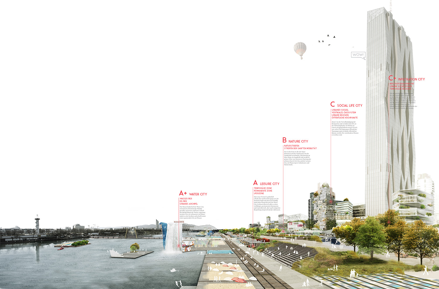
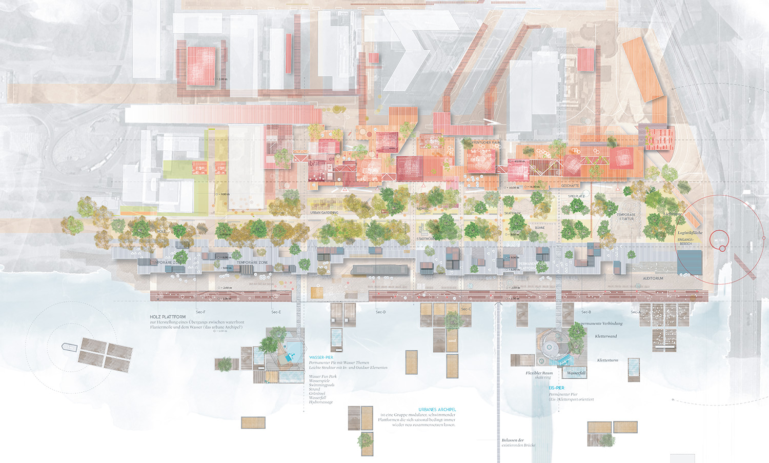
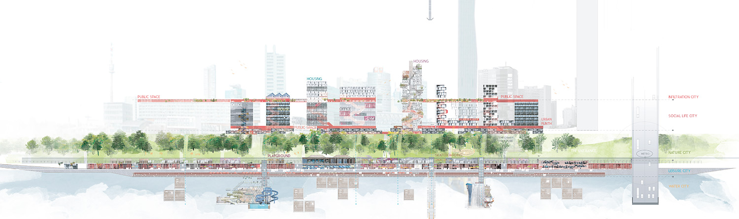
During the last year we have been busy with several projects and competitions (including the latest Open Shore project for West Palm Beach) which didn’t give us the time to look back and reflect on some of our projects from the last few years.

As maybe some of our readers know, Ecosistema Urbano has been working on several large-scale projects in Latin America since August 2014 when we won a competition to develop the Master Plan of the Historical Center of Asuncion, Paraguay. In 2015, we accomplished another significant project: the participatory process Centro Histórico Abierto for the transformation of the historical center of Distrito Central, capital of Honduras. We also worked on the transformative Cuenca RED project which acted on the Public Space Reactivation Plan of the Historical Center of Cuenca, Ecuador. After the first experience in Paraguay, we had another project in the city of Encarnación, giving origin to the Plan Encarnación Más, composed by an Urban and Territorial Planning and Sustainability Plan.

In these four cases, the urban issues and the peculiar situations that required our intervention were distinct yet shared many common features. More specifically, the enthusiasm and interest shown by the people directly and indirectly involved was apparent throughout all of the projects, but also the opportunities that these experiences have given us as an architecture firm, to test ideas, tools, and methodologies.

CONTEXT

Although they share the same area of origin, each of these cities has developed unique problems and issues. Some of these, such as the ones found in Encarnación, are physical-territorial matters such as the recent loss of the city center because of the controlled rise of the water level in the Yacyretá dam. That event led to the envisioning of a “Sustainable Development Plan” and  “Urban and Territorial Ordering Plan” in order to prepare the city for the future. In the case of Cuenca, the need for a new plan was determined by a series of big changes underway: the definition of a new model of mobility and the progressive emptying of population that afflicts the historical center, World Heritage Site since 1999, and headquarters of most of the commercial, touristic and economic city’s activities. In the case of Asunción and of the capital of Honduras, the project regards the transformation and the regeneration (both physical and social) of their historic centers. The Distrito Central is part of the development framework of the new urban axis “Choluteca River”.

SOCIAL

1 – Participation

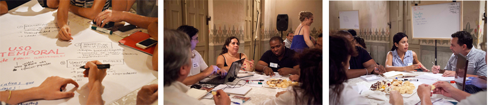
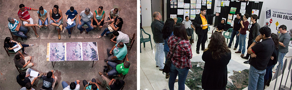
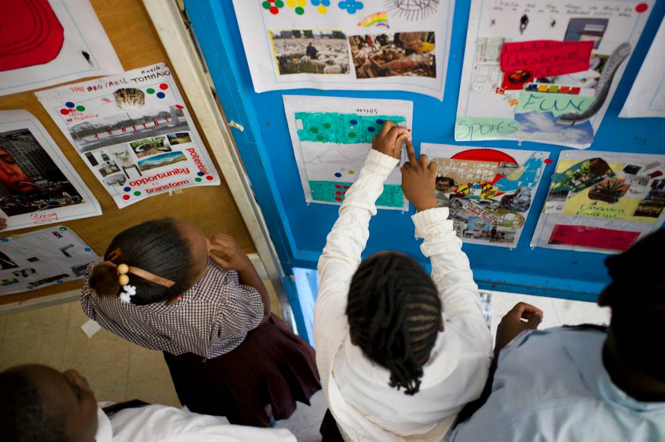
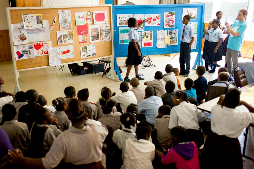
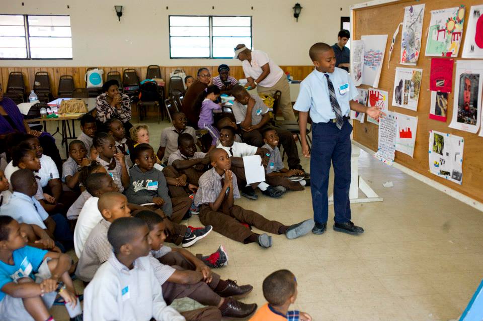
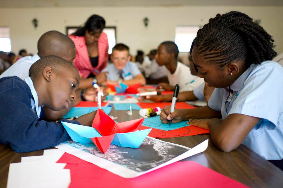
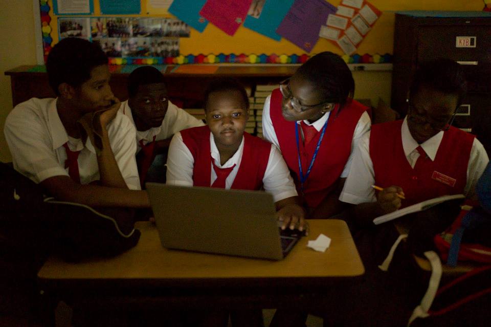
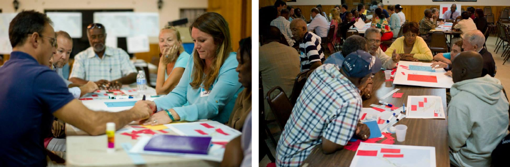
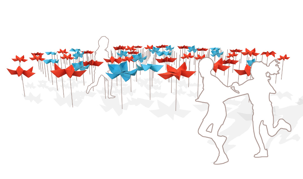
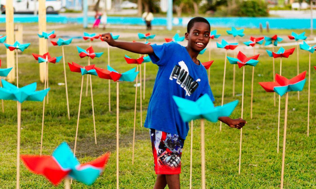
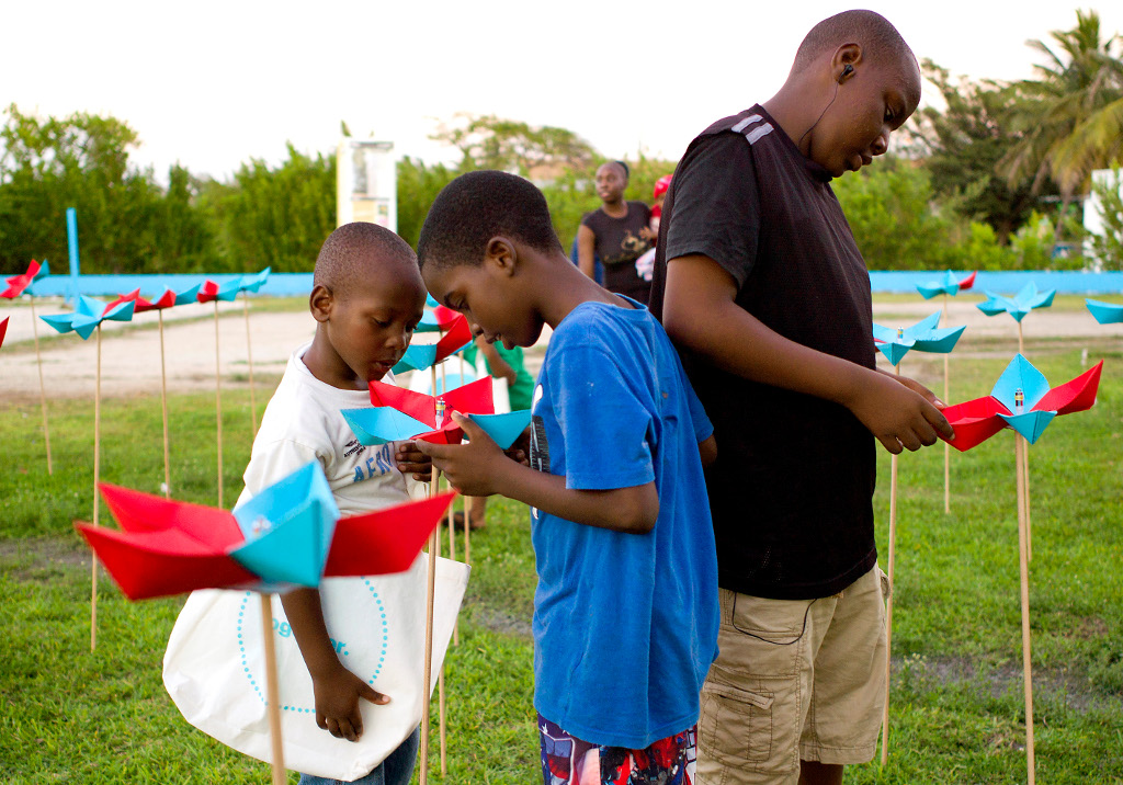
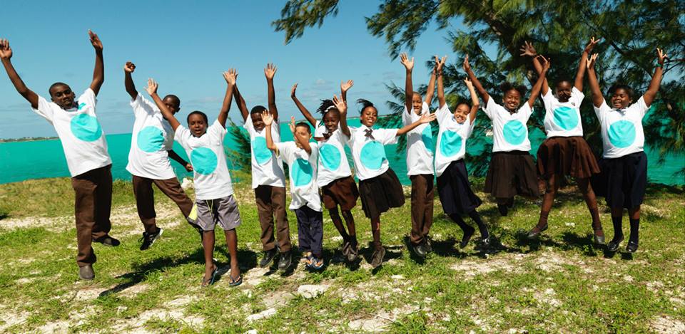
The first of the projects’ common keys are connected with the theme of sociability, expressed in the form of participation. The citizens’ involvement, promoted both through a series of organized activities and through online platforms, has been one of the cornerstones of our work in Latin America. We involve citizens because we believe that the citizen is the only force able to achieve a deep and lasting change in the urban environment and so they should not be just a passive receptor of the changes promoted by the city’s institutions. That’s why in some cases, as in that of Asunción with the ASU-LAB, a space was created which could serve as an interface between citizens and institutions: a place for the execution of the city planning but also an open place where each person or group can drive a new regeneration initiative or attend a course.

Organized activities with the citiziens

Organized activities with the citizens

Participatory activities, such as workshops and events, have been geared to address representative members of the city such as children, university students, “active agents”, citizens and institutions. For each of these categories we have developed, project after project, a series of ad hoc initiatives.

Participatory process in Asunción, Encarnación, Cuenca and in Distrito Central

Participatory process in Asunción, Encarnación, Cuenca and in Distrito Central

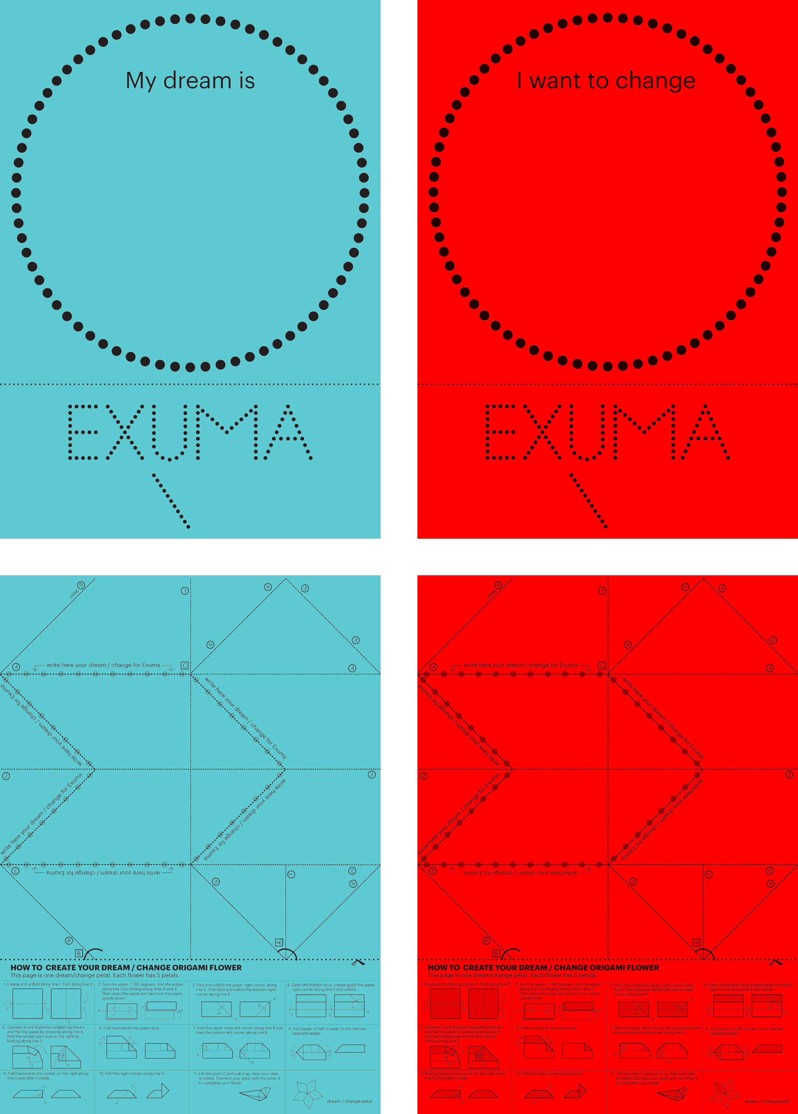
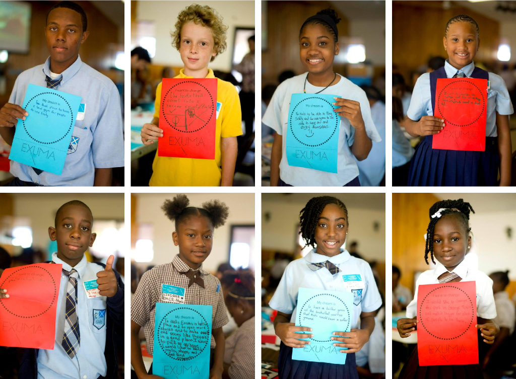
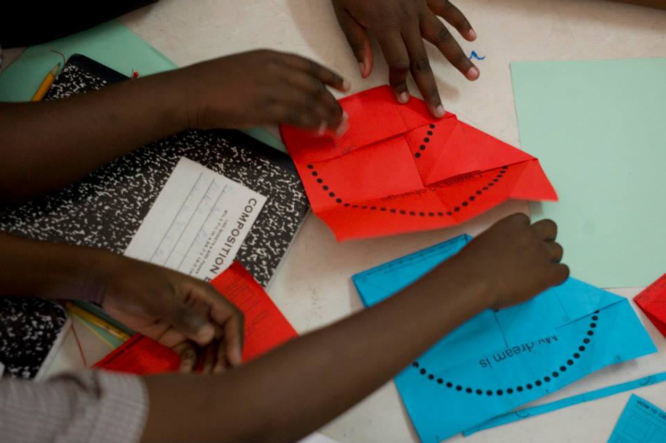
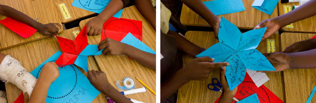
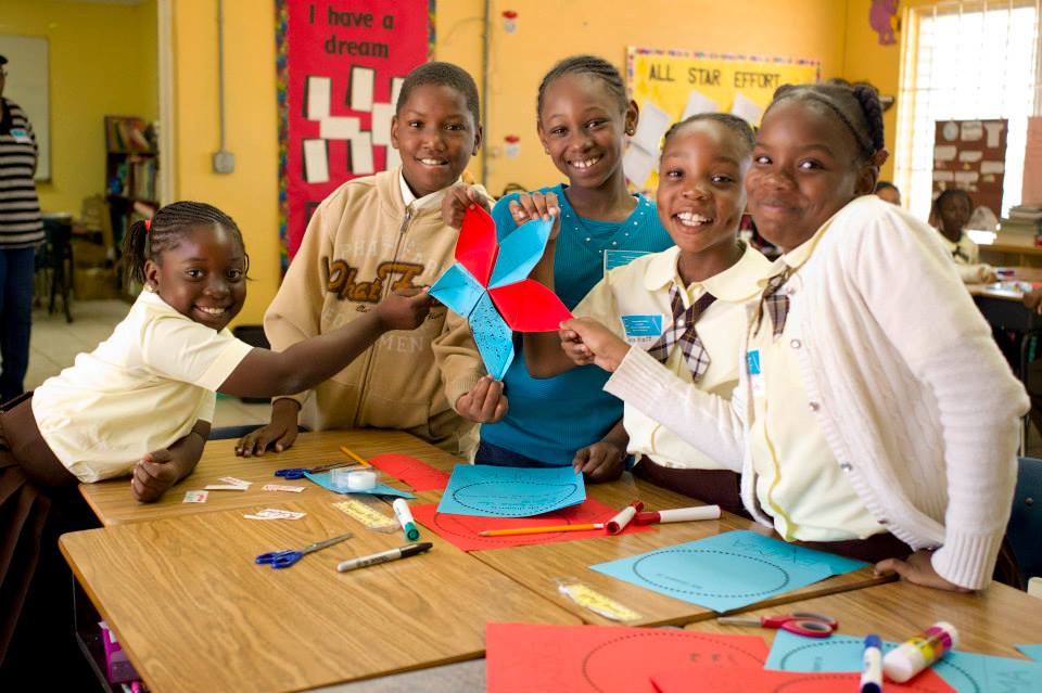
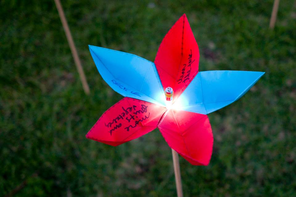
For the children we created a “toolkit” with which we had them reflect on their perception of the city and with which they could propose their ideal vision for the city. The kit consists of portions of the city map on which they could draw and that, once recomposed, could recreate the overall image.

2 – Urban actions

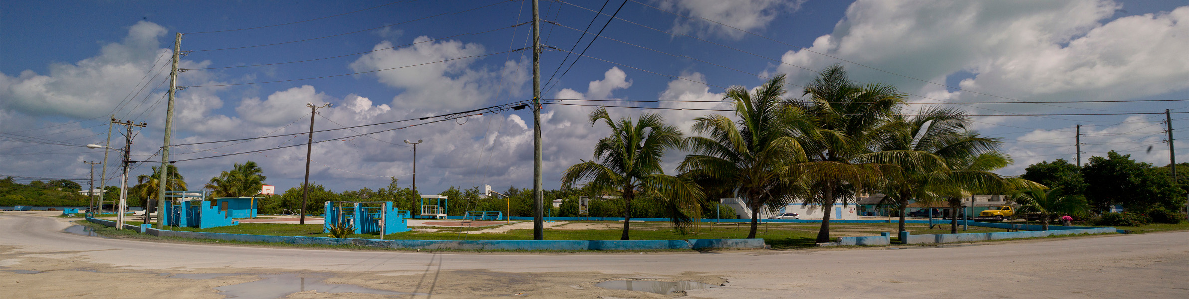
These activities were followed by a series of urban actions so that the results could be shown tangibly in the city. In the case of Distrito Central, ideas were gathered in a week of workshops with 80 students from the three major universities in the city and have been translated into urban actions like “Las Gradas de la Leona“. The staircases are indispensable spaces in a city with a very distinct topography as Tegucigualpa. But in the city these vertical connections are often perceived as inhospitable, dangerous, and dirty places and therefore they are cut off from any kind of activity. The students’ work was aimed at legitimizing these stairs as a public space through cleanliness,  decor,  lighting, and the organization of a series of activities that achieved resounding success and participation.

Socialization along "Las gradas de la Leona"

Socialization along “Las gradas de la Leona”

In the case of Encarnación, one of the proposals that has distinguished our approach in this project was the inclusion of a series of pilot projects that accompany and translate into concrete proposals within the “Plan de Desarrollo Sustentable” and the “Plan de Ordenamiento”. Among these, one of the most successful pilot projects was the “Proyecto Piloto Bicisienda“, whose purpose is to improve the quality of life of the inhabitants by optimizing the use of alternative mobility and by raising awareness of the value of sports and recreation. Again we have sought the cooperation of citizens by promoting a series of initiatives (such as the construction of bike lanes in the city) in which the citizens could feel protagonistic.

Proyecto Piloto Bicisienda

Proyecto Piloto Bicisienda

3 – Informative events 

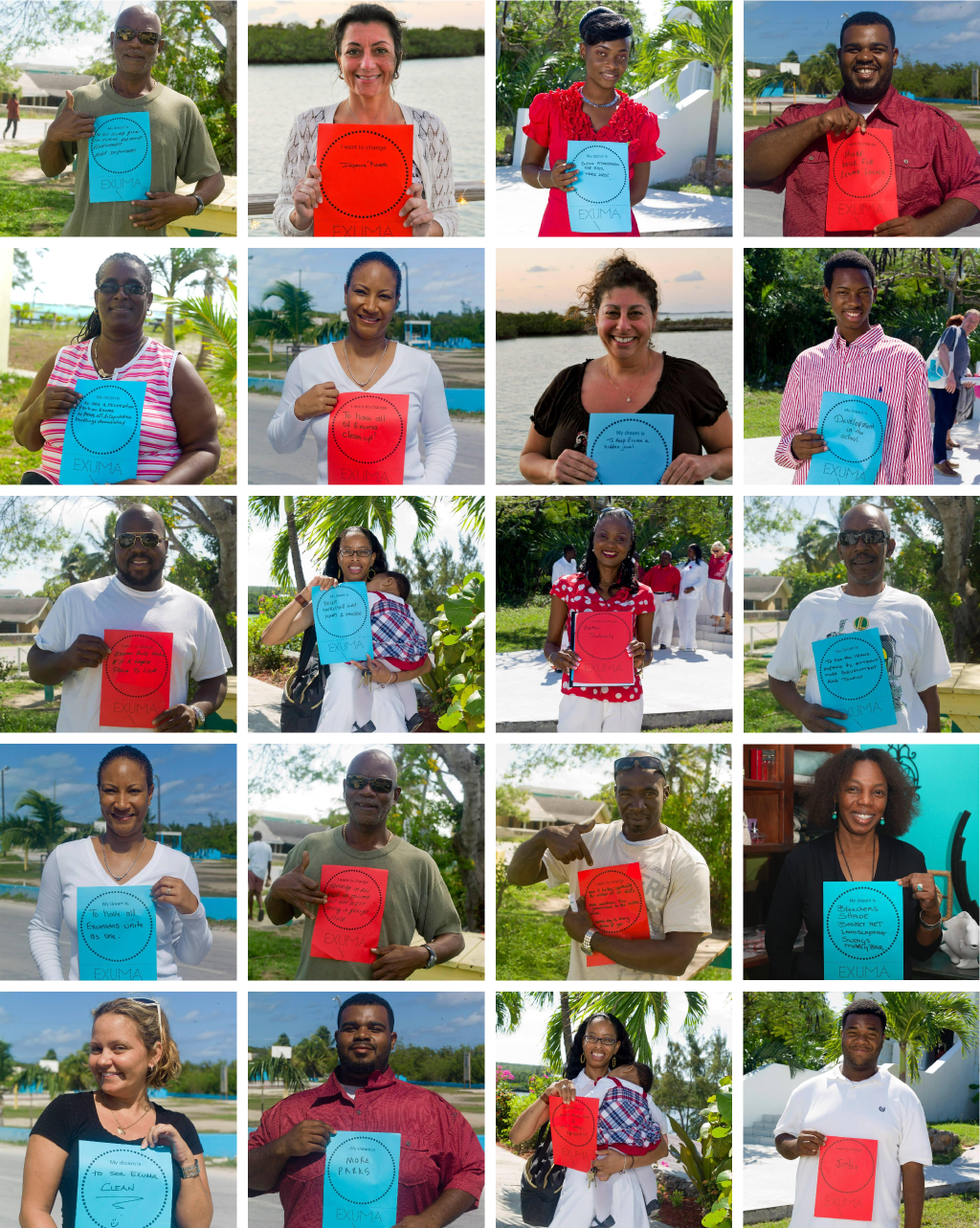
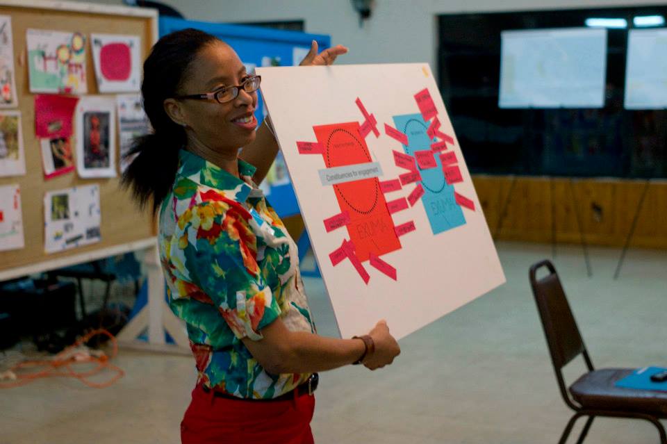
The disclosure of the participatory process to the citizenship, promoted both online through the project’s platforms and through open exhibitions, is a recurring phase in all four projects. We felt it important and necessary that each phase of the process was documented and could be easily accessible to all so that the citizens could be informed about the progress made in the project. Among these, the most scenic event, realized in Tegucigualpa, Cuenca and Encarnación, was the creation of a ” mosaico ciudadano“, a wall made of post-it notes with written words, phrases, and ideas about the city.

City mosaic in the several projects

City mosaic in the several projects

SUSTAINABILITY

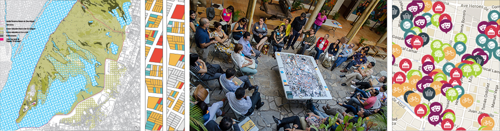
Another theme of our projects in Latin America is sustainable development expressed in various forms: care and attention to the environment, the introduction of an alternative mobility system, the importance of education to the environment as an engine of sustainability, and the development of the project made in collaboration between private initiatives and institutional management. In the case of Cuenca, for example, our intervention was partly required as a consequence of the municipality’s willingness to define a new model of mobility for the historical center of the city consisting of ceasing car traffic in the center and building a new tramway system. This new model of mobility has direct implications for the current urban dynamics, as well as on the public space, as it tries to reduce the vehicular load of the city, giving priority to pedestrians and cyclists. This, and the creation of quality public space, led to strengthen the social, economic, and cultural role of the city’s historical center making it more pleasant for residents and locals. Our aim is to activate a historical center that promotes social, economic, and environmental development, as well as a more livable, habitable, and inhabited historical center.

Cuenca’s plan is divided into four aspects: an urban acupuncture strategy, which proposes small / medium-scale interventions to recover areas with potential; a development of a network of active courtyards, by transforming the typical patios of Cuenca in catalysts capable of generating new synergies, connections, and interactions between residents, visitors and inhabitants; a guide to the historic center re-design, which defines the main lines for the design of the public space; a process of socialization, to define the “acopuntura” and the active patios network strategies. The intervention strategy in the square “Mary Corilè” in conjunction with the creation of “La casa en el árbol” is part of the active patios network strategy. This square is an unused and degraded space, perceived by the residents as an unpleasant and dangerous place.

The square "Mary Corilè"

The square “Mary Corilè”

Among the several interventions proposed, such as the re-furnishing of the square, traffic closure, and the design of activities in collaboration with the municipality, there’s also the creation of “La casa en el árbol“, a space included in the existing trees of the square where educational activities in relation to the theme of the environment can be carried out. “La casa en el árbol” is set up as a space to get in contact and be familiar with the nature, built in harmony with the surroundings. Inside there are several “environmental” classrooms in which one can study natural resources such as sun, wind, and water. More specifically, one can study: a system of photovoltaic panels that generate the energy needed for the lights, rainwater harvesting structures, and urban gardens as environmental and ecological experiences for schools and kindergartens. It is, ultimately, an open classroom in which a new form of pedagogy built on the respect for the environment is proposed, in order to increase awareness of the natural resources and of their use, as well as increase awareness of existing technologies.


In the case of Asunción we proposed a strategic plan with ten actions in order to promote a connection between the several parts of the city through the development of spaces, named “corridors“, and of individual buildings, named “urban catalysts“, which might act as drivers of change and benchmarks within the city. The corridors are divided into three types: those “green“, which introduce a new green infrastructure in specific parts of the existing roads; those “civic“, which consist of a new network of public spaces along the roads in order to connect the most important historic and government buildings; those “dynamic“, aimed at creating active urban environments and encourage economic and cultural activities.

Configuration of a charateristic dynamic corridor

Configuration of a charateristic dynamic corridor

Among the actions of Asunción strategic masterplan one concerns the economic and landscaping regeneration of the “Green Active Coast”. Due to its topography, this area is subject to cyclical floods because of the rising water level of the Paraguay River. That forces the inhabitants of the informal settlements who live there to move temporally. While fully respecting the identity of the river and of the existing topography, we have proposed the creation of a green lung with a large sports area in continuity with the Bicentennial Park. We also promoted the integration of the informal settlements both within the urban fabric and in the areas of new urban expansion.

The Encarnación masterplan incorporates within its own name the concept of “sustainability”, since it is composed of the “Plan of Sustainable Development” and of the “Plan of Urban and Territorial Organization”. The “Plan of Sustainable Development” will establish the standards and mechanisms for the growth and for the future development of the city according to the criteria of sustainability. The “Plan of Urban and Territorial Organization” aims at directing the use and the occupation of the territory in the urban and rural areas of the municipality. Officially, the city will face in the next twenty-four years an increase of the population amounted to 62,000 people, for whom it will be necessary to provide a massive increase in housing. The model we proposed to face this need refers to the sustainable principle of “the compact city.” Through the identification of a physical border for the city’s urban growth, we have protected the rural areas from new settlements. Moreover, we encouraged, through private and municipal initiatives, the densification of areas already developed, by filling the vacant urban lots and expanding pre-existing single-family homes.

Example of urban densification

Example of urban densification


The new interventions follow the principles of the bioclimatic architecture: large overhanging roofs and vegetation as protections from the hot summer sunlight, the use of wind to moderate the hot and humid climate of Encarnación, the reuse of rainwater, and the increase of the vegetation to absorb CO2 emissions.

TECHNOLOGY

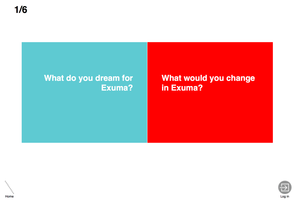
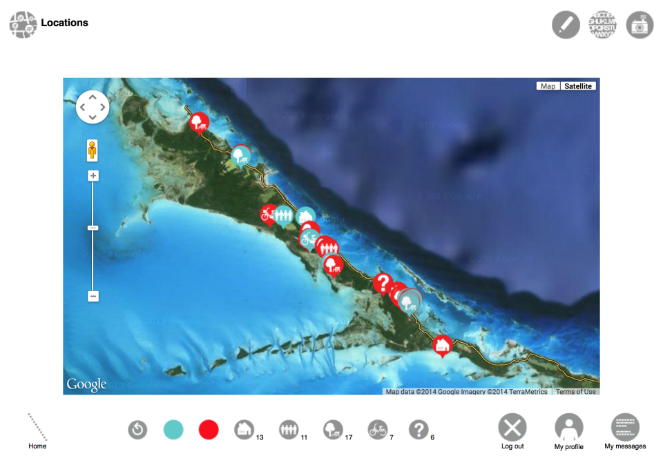
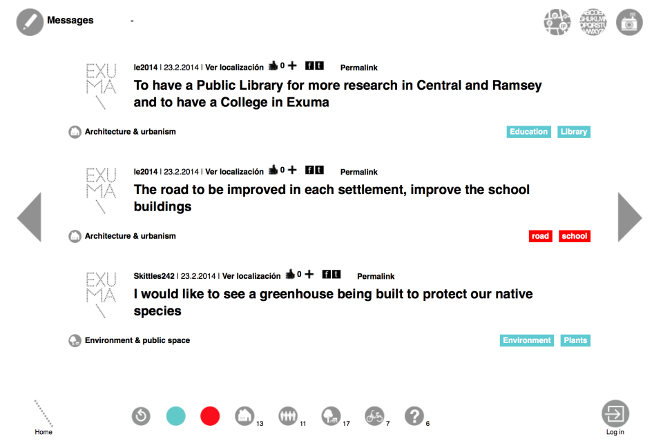
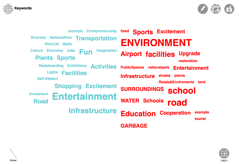
In all four projects, technology represented an important collaborative tool to promote our work and to enable everyone to be constantly updated on ongoing progress, but also as a support for the participatory process, so that the involvement of the citizens would not be exhausted with the end of the activities organized, but could continue to map needs, issues, concerns and initiatives for those interested.

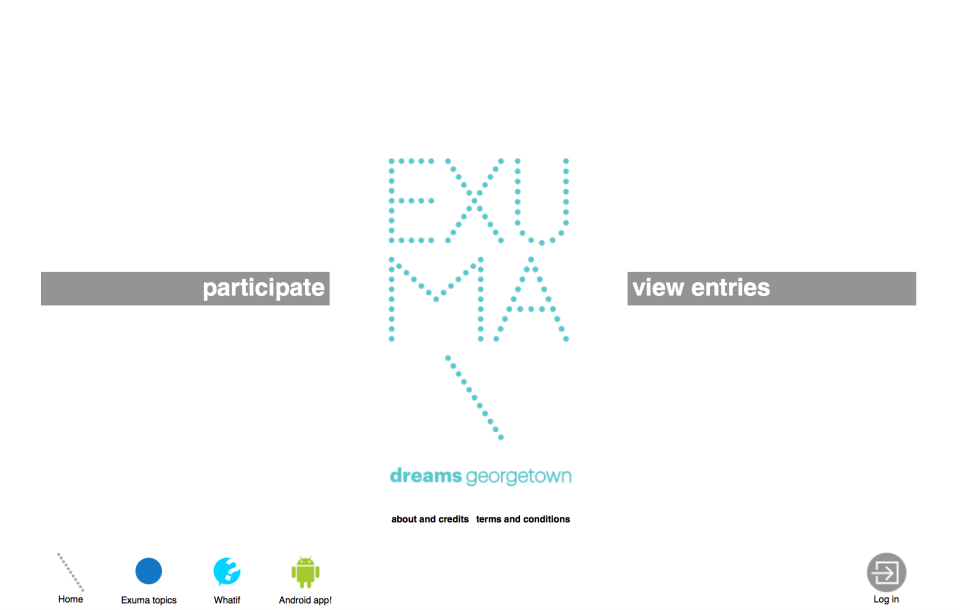
For this reason we have developed a platform, called Local-in (formerly What if ..?), which has been adapted to each project according to their personality and to the peculiarities of each participatory process, while maintaining a common format. Local-in is a free and accessible to everyone application of collective mapping. In it, registered users can add messages, photos and geolocalised links, sorting them into categories and labels. It’s easily installable and customizable, in perfect harmony with the spirit of the projects themselves, and it can be found for each project under the name “AsuMAP” for Asunción, with the name “Encarnación Más” for Encarnación, as “Cuenca RED” for Cuenca and with the name “Centro Histórico Abierto” for Distrito Central.


Comments: (0)

Ecosistema Urbano’s proposal for West Palm Beach… now published!

Category: ⚐ EN+architecture+city+competitions+design+landscape+sustainability+technologies+urbanism

We are very excited to share with all of you the final document of our proposal for West Palm Beach, Florida, U.S.A.

continue reading

Comment: (1)

City Splash! for Copa Cagrana Neue | ecosistema urbano + transform.city proposal for Vienna

Category: ⚐ EN+architecture+city+ecosistema urbano+landscape+news+sustainability+technologies+urbanism


Last November we were selected, in collaboration with Transform.city, to participate in the Neue Copa Cagrana International shortlisted competition in Vienna (Austria). The scope of the competition was the urban revitalization and definition of the Master Plan in the area Neue Copa Cagrana defining an urban proposal and the relationship of this part of the city with the river.
We were selected along with other 8 teams, including renowned firms such as Dominique Perrault, AZPML, or West 8.

The context: Donau City, Vienna

The study area is located next to Donau City, on the left bank of the new Danube Canal, Neue Donau, passing through the city of Vienna. It is a neighborhood of mainly tertiary character with office buildings of great height, developed in the last 20 years, including the Vienna International Centre.

Copa Cagrana – the intervention area, between the Danube and the new urban area with the D. Perrault’s tower

Despite the good connection with the city center, the large number of buildings and the excellent existing natural qualities, the area is almost deserted during day and night. This is mainly due to the lack of variety of uses, commercial facilities and recreational areas.
The proposal develops a series of strategies to revitalize an area that already has the optimal conditions to become a landmark for the city of Vienna:

FOUR OBJECTIVES

1 – Increase density and urban mixture

The proposal aims to incorporate urban, commercial and leisure life at a time when Vienna is starting to look for other forms of identity for the river area. It is important to bring new residents to help to create urban activity throughout day and night, summer and winter seasons by permanent and temporary uses. The mixed-use and residential functions in the first row, including the urban boulevard, have the potential to complete and complement the existing urban fabric and establish, for the first time, the necessary connections to make Donau City a functioning and exciting neighbourhood.

Activity diagram for the different seasons

The project proposes a high density urban prosthesis, combining housing, office, commercial and public space, in order to create an active urban spot connected to the surrounding, improving its identity and multiplying the possibilities of use.
The proposal seeks to make Donau City easier to be understood and perceived, with a clear connection to Danube river and its waterfront. Therefore, the proposal is the missing link to the completion of the Donaustadt and is, at the same time, the necessary catalyst to enable the urban regeneration in the area.

2 – Create new urban spots

Copa Cagrana will be an exciting new urban spot in Wien, which is perfectly connected to the city network thanks to the transport connectivity and subway line. Through the physical proximity with existing Donau City, Donau Insel and surrounding neighborhoods, the area will increase popularity and will offer more attractions to the users.
The newly created waterfront will be an urban catalyser with a variety of urban functions, with uses according to the seasons and day and night time:
The FILTER ZONE is a more quiet area free of commercial activities.
The TEMPORARY ZONE changes according the different seasons, with beach bars in the summer, pop-up restaurants, terraces and platforms, etc.
The WATERFRONT is an enjoyable walkable strip with piers and exciting water activities for summer and winter.

The FILTER ZONE

3 – Renaturing (urban+nature landscape)

A new urban and natural environment intrinsically connected with surrounding nature.
It will be the connecting environment between Donauinsel and Donau Park but also extending its limits over the water landscape of Neue Donau to create a vibrant and diverse waterscape.


Masterplan 1:1000

4 – Digital Identity – web app strategy

It is important to create the communication channels in order to advertise and share information about the ongoing activities and as a way to share potential ideas to be implemented. This web APP is thought to work as a social network that provides information for the citizens of Copa Cagrana on what kind of activities they can do on this renewed urban area.
Users will be able to register and create a user profile, with this, they will have the opportunity of proposing activities that will make use of the beautiful surroundings and installations of this urban space. The commercial sector will also have their own space. They will have the possibility of creating a profile which will allow them to publicize their products and business, as well as invite and inform citizens about special deals, offers, events and other celebrations.


FIVE NEW URBAN ZONES

Cross Section

Seeking to achieve these four objectives, the proposal creates 5 zones acting together and related to each other:

Zone C+: Infiltration city

The energy of city life will splash towards Donau City and the urban plinth will extend its limits to bring activity and reconfigure the public spaces around the corporative and residential buildings. These urban tentacles will extend urban plinth limits with linear and small scale pavilions, pop-up stores and cafes, etc. reconnecting and renewing the pedestrian pathways of the Donau city.

Elevation

Zone C: Social life city

Zone C proposal is the most powerful urban energy boost, as it provides a large amount of overlapped new programs and public spaces easily accessible at different levels.
Areas:
Urban plinth: fragmented construction from 1 to 4 stories high, multiple programs with predominance of commercial spaces overlapped with public spaces at different levels.
Vertical ecosystems: housing towers with a myriad of different typologies to create a diverse neighbourhood. The housing units help to create a dense neighbourhood with urban life throughout the day.
Urban bridge: On the tenth floor, same level as the top terrace of the existing linear building of social housing, a bridge is creating connections between semi public spaces, with diverse programs within the vertical ecosystems.
Public peaks: the top floor of the different towers is also part of the network of semi public spaces within the vertical ecosystems. These spaces can hold multiple programs and part of their success will be the privileged point of view of the city (terraces, cafes, common spaces,… )

Zone B: nature city

This is a zone where nature is predominant and the urban plinth is melting its limits with the landscape. At the same time, the natural character of this area helps to make the transition between the bigger, urban scale of zone C and both the lower scale of zone B and the waterscape towards Donauinsel, combining natural areas with paths for soft mobility.

Different cross sections in zones A and B

Zone A: Leisure city

Leisure cityscape to allow the transition between the formal city and the vibrant and ever changing new waterscape of zone C+. It will hold multiple permanent uses but also temporary programs and seasonal activities. There are multiple temporary and permanent uses in small buildings with similar language, as well as a new riverside walk that will extend to create a comfortable linear space. The relationship with water and the elevation difference will be resolved with a wooden platform that will act as an urban sofa to relax and enjoy the presence and proximity of the river.

Zone A+: Water city

Vibrant and ever changing waterscape in continuous evolution. It will extend the activities of the new urban spot towards the water.

Masterplan 1:2000

+ water pier: permanent pier, water thematic. Light structure with indoor and outdoor spaces to allow the creation of different bathing experiences. The use will change seasonally, during the winter, outdoor and indoor climatized pools will allow the user to be in connection with the surrounding natural landscape while having a pleasant bathing experience.

The water pier for summer activities

+ ice pier: permanent pier, ice and climbing sports oriented. Light structure with a strong seasonal connection. During the winter, part of the structure will be a huge frozen and faceted vertical surface to practice ice climbing, while the lower platform will host different ice skating outdoor rinks to practice in connection with the water and natural landscape. During the summer the ice surface is transformed into a huge waterfall falling from the upper level into the river.

ice pier_con nieve

The ice pier for winter climbing

+The urban archipelago: big modular and floating ever changing extension of the waterfront. The different seasons and uses will dramatically transform its configuration. This mutant landscape is built with modular floating platforms/barges that can be combined to create larger flat surfaces if necessary. These platforms can be connected to the limit line of the waterfront to extend its surface.

If you want to know more about the proposals you can download the competition panels here:
Panel 1   Panel 2   Panel 3   Panel 4

Comments: (0)

ecosistema urbano at 2015 Shenzhen — UABB bi-city biennale of urbanism and architecture

Category: ⚐ EN+architecture+ecosistema urbano+events+networkedurbanism+news+research+technologies+urban social design+urbanism+video


overall view

Between November and December 2015 we spent one week in Shenzhen on the occasion of the 2015 Bi-City Biennale of Urbanism/Architecture, being invited by curators Alfredo Brillembourg and Hubert Klumpner to be part of the Radical Urbanism section of the exhibition. The brief of this edition of the Biennale is “Re-Living the city”, a reflection about reuse and rethinking existing buildings, the reimagination of our cities, and the remaking of our daily lives by design. The main location of the event was connected to the topic of the Biennale: the former Dacheng Flour Factory has been transformed into a massive container of thoughts and innovative practices in urbanism without hiding its recent past of industrial activity and its uncertain future.

The Dacheng Flour Factory_ Image: UABB

Our installation at the UABB Biennale, called Networked Urbanismdisplays a selection of pilot projects exploring physical and immaterial urban improvement, a critical catalogue of their urban contexts, the understanding of urban complexity and the new tools developed to address it. The colourful multimedia exhibition displays 10 pilots projects, implemented during the past 10 years in different contexts around the world, but also displays 1 mockup, a real scale version of an urban furniture design.

1

The Networked Urbanism Installation reflects the working method: an overall strategic vision that relies on short term punctual and powerful interventions in specific and emblematic spots (pilot projects), rather than long term and high resources urban strategies. Ecosistema Urbano’s projects empower people and engage citizens in the tangible transformation of the places where they live.

The definition and final layout of the installation was an intense process of research and real scale experimentation to find interactions between graphic design, communication, animation and optical effects. We tried to show the common philosophy behind each project in a very visual and communicative way. Each pilot project is communicated with a graphic slogan synthesizing the nature of the intervention and its message, a reference to the city where the project is implemented, and a description of the overall urban strategy.

slogan

3


10 pilot projects

Moreover, a digital layer of information is added to the graphic display. 5 multimedia dioramas provide an intriguing representation of the following pilot projects: Exuma Garden of Dreams, Dreamhamar, Asunción Open Lab,  Voronezh Sea Revitalization, and Encarnación Sustainable Development Territorial Plan.

Diorama for the project Dreamhamar

The other 5 pilot projects presented in Networked Urbanism installation are described throughout short movies displayed as holograms, thanks to a DIY fascinating technique. The videos of the projects Ecobulevard, Air Tree Shanghai, Ecópolis Plaza, Energy Carousel, Escuela Febres intervention in Cuenca , explain with 3d holograms the complexity of this interventions, showing the different layers and their several possible points of view and configurations.

Hologram of Ecobulevar project

1 Mockup
Well centered on the main wall of the space lays the message “Customize public space“, surrounded by drawings of the possible configurations of Madrid Chair. In the central area of the exhibition there are 18 pieces of this flexible and multipurpose urban furniture in red and orange versions allowing visitors to interact and create their own favourite exhibition layout.

Assembly phase of Madrid Chairs

7

The UABB Biennale will be open until March 3rd 2016, if you are planning to visit Shenzhen, don’t miss it!

Comments: (0)

New workspaces, connecting the physical and digital spheres

Category: ⚐ EN+architecture+competitions+creativity+ecosistema urbano+research+technologies

ph+dg_654

During the past months, in the framework of a shortlisted competition for a new working+retail space in the Middle East, we developed a research about the possibilities of contemporary workspace and how the digital layer influences the physical configuration, enhancing and multiplying the possibilities.

Last Fall we were teaching at the Master in Workspace Design at IE University, leading the Technology Lab; so this exploration became a continuation of our previous research and work.

We have been studying the contemporary way of working / thinking / living, analyzing the current phenomena affecting the spaces where the working activities take place. We believe that the digital revolution and contemporary socio-political dynamics call for reflection on the way we work. Spaces and instruments for working, methods and hierarchies, places and distances have all been brought into question. Beyond and around working, there is an ongoing change of paradigm that involves almost every aspect of culture and society. The way we address and manage processes, products and knowledge is evolving aided by new technological possibilities and critical “meta” reflections: From competition to collaboration and cooperation; from centralization to P2P; from pyramidal structures to grassroots, horizontal ones; from professional secret to transparency; from private R&D to crowdsourcing; from intellectual property restrictions to copyleft and free/open source initiatives, from well finished products or services to open roadmaps that embrace perpetual beta…

Our research focused on the following challenges:

How can architectural, physical work space, aided by its digital equivalent through hybrid interfaces, incorporate those emerging ways in order to support further exploration?

How can we, architects/designers, provide the best built environment for these emerging impulses to become fully developed?

Our philosophical approach divided the subject into three main spheres of research:

+ The Physical Sphere
Understanding the contemporary workspace as an innovative and experimental balance between design (size, material, color, behaviour, structure, relative position between elements,…) and conditioning (hygrothermal comfort, privacy, noise levels, lighting,…) to be implemented so as to be responsive and truly supportive.

Print

+ The Digital Sphere
We focused on the digital “cloud” associated to each space to enable experimental environments, unprecedented interactions and ways of communicating, or wider, faster, more open-access to knowledge. We considered the digital sphere in workspaces as a unique open environment, extremely user-friendly, flexible and customised according to the specific circumstances it will be used for: supporting internal work, influencing digital marketing strategies, involving customers and external visitors, instigating social activities.

Print

+ Physical-Digital Interaction
We design spaces that enable the best interaction between users relying on a physical comfort and the digital layer. We focus our work on how mutual management, communication, control, connection and interaction can work between the physical and the digital. This specifically involves physical interfaces that operate on the digital side and digital interfaces that influence the physical space.

DIAGRAMA workspaces-03

In order to achieve the integration of physical and digital spatial configuration, we developed a design strategy around four main actions we believe as relevant for an innovative workspace:

4 actions

– Inspiring
Innovation requires firstly an inspiring environment in order to provide an experimental incitement to creativity through different channels.
We believe in the possibility of feeding creativity through a series of activities that inspire our brain and stimulate it to go beyond boundaries and create big ideas.

– Well Being
A workspace should provide a high comfort level for the people using it. The environment should be equipped with all the facilities that ensure the best ambience for every particular situation and need.

– Challenging
Being satisfied by its own conditions, sometimes is not the best way to bring innovation. The only possibility to improve is going beyond and accepting challenges. In the contemporary work scene, innovation is an indisputable fact. But, for instance, how to stimulate a company that is already in the innovation sector to exceed and excel constantly? We believe that a good training in accepting new challenges even in the small everyday things could help a lot. Through simple dynamics that boost self confidence, cooperation between members of a team, enthusiasm towards the new and unknown and establishing an informal and playful way to invent new solutions for everyday issues as well as exceptional conditions is an excellent way of ensuring high levels of performance.

– Networking
We believe the strength of a successful company is in the quality of its structure and components, but just as important is the network that is able to create, expanding its connections and sharing an learning with/from others.

We keep this line of research open. So, if you want to contribute with it, by sharing a paper or article around the topic, we will be happy to publish it, to spread the ideas and inspire others!


Comments: (0)

Chatter: Architecture Talks Back, Exhibition at the Chicago Art Institute

Category: ⚐ EN+design+dreamhamar+ecosistema urbano+events+news+technologies

Chatter_Expowering_04_david_schalliol

Photo: David Schalliol

Last February we were invited by the Art Institute of Chicago, the second largest museum of United States after the Metropolitan Museum of Art, to participate in the exhibition Chatter: Architecture Talks Back, an exhibition curated by Karen Kice and Iker Gil. The exhibition explores the new possibilities that technology offers to communication in architecture, aiming to establish an ideal dialogue between architecture’s present and past. The thesis of the exhibition is that Chatter is the new way for architects to communicate their ideas; social media as Twitter and Instagram are nowadays working tools for architects to produce and present their work. The exhibition focuses on the creative process of some international architectural firms, such as: Bureau Spectacular, Erin Besler, Fake Industries Architectural Agonism, Formlessfinder, and John Szot Studio; and highlights how they conceive new designs and ideas that reflect upon and expand the legacy of their field.

Chatter-Architecture-Talks-Back_480

Cartoonish Metropolis, 2011. © Bureau Spectacular.

In this framework we were invited to exhibit our project Dreamhamar in the Gallery 283, in the section curated by Iker Gil, Director of the design publication Mas Context. In this part of the exhibition, that explores the multiple ways in which architecture can be communicated, our work represented the section “Empowering”, one of the concepts used to support the thesis of this section, together with others as “Challenging”, “Satirical”, “Collective”, “Revealing” and “Diagnostic“.

Chatter_Overall_01_david_schalliol

Photo: David Schalliol


Chatter_Expowering_01_david_schalliol

Photo: David Schalliol

The projects presented in this space were produced by a range of practitioners worldwide: Ecosistema Urbano; over, under and pinkcomma; Mimi Zeiger and Neil Donnelly with the School of Visual Arts Summer Design Writing and Research Intensive; Koldo Lus Arana (Klaus); Project_ with Sarah Hirschman; 300.000km/s with Àrea Metropolitana de Barcelona; Luis Úrculo; and Christopher Baker.

collage

Photo: David Schalliol


twitter installation

Photo: David Schalliol

If you are planning to go to Chicago, don’t miss it! It will be open from April 11th, 2015, through July 12th, 2015 in the Architecture and Design galleries in the museum’s Modern Wing.

Comments: (5)

5 Cycling Apps Every Urban Cyclist Should Know

Category: ⚐ EN+technologies

5603678937_8ec8fd2449_z

Photo gently borrowed from mcfarlandmo, under a attribution-non-commercial creative commons license

Remember Bikeline, our awarded idea for a cycling app? We’ve been thinking about it lately, and decided to make a post about some other smartphone apps that might be interesting for urban cyclists.

You may have already heard of names like CityMapper, Strava or CycleMeter. It seems like most of the cycling related apps available fall on the category of route planners, sports or trackers. So we decided to talk about other types of apps, both available or soon-to-be lauched.

BikeRepair

Every person that rides a bike knows that some mechanic skills will eventually come in handy. This app will teach you all you need to know about maintenance and repairing of your bicycle. It consists in 58 step-by-step guides and 95 tips and tricks, also about riding-related aches and pains. One important thing: all of these repairs don’t require special tools; in other words, it’s accessible to beginner cyclists.

bikerepair_620

Platform: iOS

Price: 2.26€ / 3.20€

Website: www.bikerepairapp.com


Fill That Hole

Even if this app is only available in the UK, it had to be part of this list because it emphasizes the importance of public participation and collaboration for a better city. This app, developed by the National Cycling Charity, enables you to take photos of potholes (one of the worst enemies for a cyclist) and other hazards in the street, and uses the phone GPS location to send the info to the local authorities. A FixMyStreet for bicycles!

Platform: iOS, Android in development

Price: Free

Website: www.fillthathole.org.uk


RiderState

This app is a game that motivates you to ride your bicycle even more. In RiderState you’ll be conquering your street, neighborhood and city, based on how much and where you’re riding. The app will register your activity in real-time, and when you’re finished it will show a map of your conquered territory as well as stats of your game and ride, like the avoided CO2 emissions. Interesting take on mobility and gamification.

Platform: iOS Android

Price: free

Website: www.riderstate.com


Bike Tap

BikeTap was born from the effort to change the way people view cycling as part of their lifestyle, from recreational to social. It’s based on social interaction and basically you gain points and rewards by each trip you’re making by bike. You can challenge your friends for bike rides, arrange a meeting with them, know if they are going by bike or if the destination has parking infrastructures. Local businesses will be able notify users, and you can also know about trends in cycling. With this app you will find additional motivation through shared experience to get you cycling more often.

Platform: iOS (not lauched yet)

Price: Unknown

Website: www.vimeo.com/urbanfuturists


Kappo

While Kappo also means to encourage cycling by gaming, it is an interesting tool for institutions and governments as well. The concept is basically the same as the previous, everytime you ride your bike the app measures the time, speed and also weather and jumps. If it’s raining, for example, you’ll be getting more points to level up and more bikecoins to use on your profile. The graphics are very appealing and the game looks entertaining; you can compete with your friends, players from all around the world and also complete some very interesting challenging achievements.

Kappo achievements, profile and results pages

kappo achievements, profile and results pages

The most interesting part of Kappo is that, while it is a game for the users, it also provides data for the local authorities. They will get insights about local urban cyclists, being able to understand patterns and behavior, in order to act better towards their needs. A very interesting win-win model, with a (yet to be fully explored) potential around the ‘bikecoin’ concept.

Analytics1-Stgo

kappo cycling heatmap. from analytics page

Platform: iOS Android

Price: free

Website: www.kappo.bike


Bikestorming

The first thing we must say about this app concept is that the creator wants to make bike the most popular transportation mode by 2030. Bold statement! The second thing is that it’s all open-based. Bikestorming is (or will be) a collaborative platform intended to promote urban cycling everywhere.

Bikestorming-Screens-2

Different pages of bikestorming app

It’s designed to be fun and cool. Basically there is a Map and Missions. The Map shows more info available for urban cyclists than any other map, and the missions are a way to expand it. In other words, beside using the info of your city, you will also be posting about parking spots, safe streets or how do you integrate bike and public transport, among other missions. All the data is open to reuse.

full_Bikestorming_20PKNBA_2032_20english_20PNG_20OK.003

Platform: Soon to be on every smartphone and lightsaber

Price: Free

Website: www.bikestorming.org

Conclusion

Bikes have remained mostly the same during decades, but contemporary technology is slowly finding its way on everyone’s handlebar, with great potential. Apart of the visual aid and information that such apps can provide, there are also some interesting explorations of a sharing economy going on here. The mix of social coins, gamification, social interaction and crowdsourcing of urban data is a very promising one.

There are some limitations, though. For example, enabling your GPS (required for almost every biking app) while you ride may take you to your destination… and leave you with an empty battery.  As these applications get more popular, systems for in-bike charging will probably be popping up, as well as more and better ways to attach the phone to your bike.

This is just the beginning!

Comments: (0)

Exuma Garden of Dreams

Category: ⚐ EN+ecosistema urbano+sustainability+technologies+urban social design

Sobrevolando el Caribe

Puedes ver la versión en español de este post aquí.

Exuma is a district of the Bahamas, consisting of over 360 islands (or cays). The largest of the cays is Great Exuma, which is 37 mi (60 km) in length. The capital and largest city in the district is George Town founded 1793 and located on Great Exuma. The Tropic of Cancer runs across a beach close to the city. The entire island chain is 130 mi (209 km) long and 72 sq. mi (187 km²) in area.

Last February, Ecosistema urbano has started a cooperation with the project A Sustainable future for Exuma: Environmental Management, Design, and Planning, a multi-year ecological planning project as a collaboration among the Government of the Bahamas, the Bahamas National Trust and Harvard University Graduate School of Design (GSD).

Situación de Exuma

The location of Exuma

The goal is to facilitate the design and management of a more sustainable future for the Exuma archipelago, and The Bahamas more generally.
The project has two parallel and mutually informing components: research and education. These components work to inform the development of proposals and interventions as well as the building of capabilities for local empowerment.

Resumen del trabajo de campo - Fuente: Exuma Topics

Field work summary – Source: Exuma Topics

Ecosistema Urbano’s role, within the overall framework of the project, has been to design a series of activities and workshops to promote dialogue within the local community, reflecting on the future of the islands and publicizing the existence and content of this future project. As a final outcome of this debate, there is a need to implement a catalytic intervention in the public space of Georgetown, as a sign of change and transformation for the future of the island.

While interacting within the local community, we obtained key information about how residents feel, what their expectations, perceptions and needs are, etc…The debate essentially stood between two scales: the general area of ​​Exuma and the local environment of George Town, the main town of the district, where most social activity takes place.

Among the many topics that emerged, some are as important as food, energy supply, education, waste, water, transport, tourism, identity or infrastructure.

There have been great moments of collective reflection on the present and future of this beautiful and fragile environment, and it has been particularly interesting to listen to the younger generation, who despite their young age, have a very clear vision of what are the challenges and problems they face to improve their future prospects.

Llegando a Gran Exuma

The toolkit and workshops that have been implemented to probe the wishes and aspirations of the local community are as follows:

1. Street photo tour

Our friend and extraordinary photographer, Emilio P. Doiztua, accompanied us on this trip, making a great record of many of the participants and activities.
We thought it was important to collect the testimonies of those who wanted to participate in more organized activities, but also of those who preferred to express their ideas spontaneously in the street, just off the Church or the market. People were very open to participate and eager to answer our questions.

Algunas de las fotografías tomadas durante el "tour"

Some of the photographs taken during the “tour”

2. Creative workshops

During the week we have been active in the primary schools of St. Andrew’s, Moss Town, George Town, Williams Town and the LN Coakley High School, working with young people between 7 and 18 years. In parallel there have been two meetings with adults, both in St. Andrew’s Community Center.

We designed a set of 2 questions, as a triggering exercise, using the colors red and blue, to symbolize the changes needed and the desired dreams respectively. Each participant was interviewed and answered these two simple questions, as an individual exercise and then proceeded to the collective exercise, in groups of 4 or 5 people.

Azul y rojo, sueños y cambios

Blue and red, dreams and changes

Many and varied were the answers, and it has been very interesting to see the clarity of ideas of the youngest (7-10 years) who suggested changes and proposed ideas fluently, both about their immediate surroundings (their school, their neighborhood, their town) as well as for the broader context, Exuma.

At the end of each workshop, through a simple origami exercise, the red and blue pages symbolizing the desired changes and dreams for the future, were converted into petals to later become paper flowers.

Plantillas usadas para las propuestas y el origami

Templates used for the proposals and the origami – click to see and download in high resolution

Proceso de plegado del origami

Folding origami

For the collective exercises we worked with aerial photos, words, producing collages and staging. There has been a reflection to 3 scales: Exuma, Georgetown and at a more local scale, around a vital public space in town, the daily most frequented place by children, youth and families.

"The park", el principal espacio público de Georgetown

“The park”, the main public space in Georgetown

This space is a natural meeting place for the teenagers and has got a great potential as a space for social interaction on the island due to its proximity to Lake Victoria and for being in the center of Georgetown.

Ubicación de este "parque" en Georgetown

Location of this “park” in Georgetown

features and allow it to be more active, inclusive and comfortable public space. Some of the ideas collected included: shade, playgrounds, street furniture, water, wifi, stands, community gardens, garden, sports facilities, cultural events, concerts, etc.

Añadiendo propuestas al panel de exposición

Adding proposals to the exhibition panel

Puesta en común

Presentation

Puesta en común

Presentation

Trabajando en los "pétalos"

Working on the “petals”

Algunos niños posando con sus propuestas

Some kids with their ideas

Aprendiendo y enseñando a plegar el origami

Learning and teaching how to fold the papers

Some “flowers” start to appear

Mostrando el resultado

Showing the result

In a local highschool

Using the digital application

Using the digital application

Adults workshop

Workshop with adults, both tourists and locals

Sharing results and reflections

Sharing results and reflections

3. Digital Exuma: www.exumadreams.org

As in previous occasions, and after adapting the graphics, we used Whatif [Edit 2015: now called local in] for digitally collecting ideas from participants. The resulting platform www.exumadreams.org, is and will remain active for the next few months as an open communication channel with all those who want to maintain the dialogue and continue to participate.

For those of you who are not familiar with the tool, Whatif is a web and mobile application designed to the publication of geolocated messages: Users write their ideas, opinions or proposals in 140 characters and classified by category and location so that they can be consulted, valued and shared in real time. We developed it as a tool to assist public participation processes and collective creativity, facilitating the tasks of consultation, exploration and visualization of a wide variety of data.
The application is open source and available for free download on the official website, which will soon be announcing a new, improved version.

exumadreams con whatif - captura de la pantalla principal

exumadreams on whatif – screenshot of the main page

exumadreams con whatif - captura de la entrada al formulario

exumadreams on whatif – screenshot of the entry form

exumadreams con whatif - captura de la vista de mapa

exumadreams on whatif – screenshot of the map view

exumadreams con whatif - captura de la vista de mensajes

exumadreams on whatif – screenshot of the messages view

exumadreams con whatif - captura de la vista de etiquetas

exumadreams on whatif – screenshot of the tags view

www.exumadreams.org

4. Origami garden of exuma dreams- Jardín de los sueños

The last day of our stay, we arranged an installation with all the ideas compiled during the entire process, an ephemeral and symbolic collection of wishes for Exuma, George Town and the public space of the city. A red and blue paper flower garden, each containing 5 petals with different ideas and desires embedded.

The Garden of Dreams allowed us to show the local community the work done throughout the process of workshops and activities, while temporarily transform a public space in Georgetown, drawing attention to the need to revitalize this space.

Boceto de concepto para la instalación

Concept drawing for the installation

La "flor" resultante

The resulting “flower”…

... y las flores formando un jardín

… and the garden these flowers form.

Personas visitando la instalación

People visiting the installation

Personas visitando la instalación

People visiting the installation

Vista nocturna de la instalación

Night view of the installation

Vista nocturna de la instalación

Night view of the installation

Otra vista nocturna de la instalación

Another night view of the installation

Now we are back and the ‘lab’ work begins. It is necessary to process all the collected material and transform the hopes and dreams of the citizens of Georgetown designing a catalytic intervention for this important public space for the community life.

More information about the project:
www.sustainableexuma.org
www.exumatopics.org/about

More pictures about the project at their Facebook page

El equipo visitante, de izquierda a derecha: Gareth Doherty, Jose Luis Vallejo, Belinda Tato, Jose María Ortiz y Mariano Gomez

The visiting team, left to right: Gareth Doherty, Jose Luis Vallejo, Belinda Tato, Jose María Ortiz and Mariano Gomez

Cheers from Exuma!

Cheers from Exuma!

Comments: (0)

Digital social tools for the city l New series: Social Toolbox

Category: ⚐ EN+social toolbox+technologies

Today we present a coming series of posts about digital social tools. With this term we mean digital platforms, software, and online projects developed for the improvement of cities and neighbourhoods through direct participation by their citizens. Digital social tools can be open platforms that allow anyone to sign up and collaborate or applications that can be applied to different participatory projects.

What is the social potential of information technology and of the development of open source software and web-based social projects? To answer this question we will begin by establishing a theoretical framework contextualizing this spreading phenomena in contemporary society. In the end we will propose a system for a graphic representation to help us better understand and compare their underlying structure.

 Marta Battistella

continue reading

Comment: (1)

MetaMap | MapTube by CASA

Category: ⚐ EN+city+internet+MetaMap+technologies+the environment

MapTube Homepage

Today I present the interview with Richard Milton, member of the research staff at the (CASA), a unit at the Bartlett Faculty of the Built Environment (The Bartlett).

CASA’s focus is to be at the forefront of what is one of the grand challenges of 21st Century science: to build a science of cities from a multidisciplinary base, drawing on cutting edge methods, and ideas in modeling, complexity, visualization and computation. Our current mix of architects, geographers, mathematicians, physicists, archeologists and computer scientists make CASA a unique department within UCL.

His current position in the centre is described as the following:

Richard is a Senior Research Associate currently working on the ESRC funded TALISMAN project, having previously worked on GeoVUE and GENeSIS. He is the key developer in these projects, being responsible for the e-infrastructure developed in GENeSIS and GeoVUE, which is currently used for real-time web-based geospatial data visualization. This infrastructure is currently used in the MapTube, SurveyMapper and Gemma websites.

MapTube is a free web resource for viewing, sharing, mixing and mashing maps online. The main principle of MapTube is that shared maps can be overlayed to compare data visually. For example, you can view a map of the London Underground overlayed with a map of building volumes to get a new perspective of the city.

Overlay of London tube map and London building volumes

1. How did you get to the practice of mapping?

I originally got into mapping by working on weather visualization systems for the UK Meteorological Office. After that, I worked on a project in UCL on GPS-tracked carbon monoxide sensors, displaying the data through both 2D and 3D views of the city. Then, I started working for CASA, developing the GMapCreator software, allowing people to create Google Maps from the data stored in shapefiles, which led to the MapTube website.

2. In what way do you obtain and treat the data for your mapping?

I often have to do a lot of pre-processing of the data before it can be mapped, but on an ad-hoc basis. The real-time data is also quite challenging as there are often errors in the data that have to be cleaned and the pre-processing for the London Underground, National Rail, and Bus data are quite involved. The data is sampled on a 3 minute basis, so all processing needs to happen very quickly.

Global McDonald’s Big mac prices, 2007

3. What is the application of the open source mapping you are interested in the most?

I think the amount of data that’s now in the public domain is the greatest interest. We are getting to the point where we are being swamped with data and need to look for methods to handle much larger quantities than before.

4. What is the next phase of development your research is undergoing?

The next phase of development is very hard to quantify. We’re looking into various things like BigData, Real-time data and DataMining.

5. What are you personal references about the theme of mapping (from ancient to contemporary ones)?

My interests are really in automatic mapping, from data and how you handle it from multiple sources (data fusion) to visualizing complex situations.

England grade of land use

This is the last post (for now!) in our MetaMap series about mapping. You can follow the conversation in your favourite social network through the #metamap hashtag.