Official website HERE, full description of the project THERE
The Wikibivouac is a collaborative map which reappropriates space to create new uses of the city. The wiki element of contibutions from anyone aggregates information for improved transient occupancy of place. We understand the value of a local resident’s recommendations and guidance – when this infomation is pooled and accessed a visitor attains a greater understanding of the true availability of resources and locations shown on a static map.
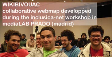
The Wikibivouac project launched as one of the ten selected projects at the Medialab-Prado’s Inclusiva-net event. Project hosts ZOOM Architecture and Damien Masson (CRESSON research lab) joined collaborators Chameleon, Cristina Braschi, Antoine Petitjean and Diego Cerda with the aim of developing the Wikibivouac concept for the duration of the event.
To do this, the ZOOM team initiated the Hunting Days sessions, worldwide searches for locations of a particular resource – free, drinkable water points, one of the most critical resources to human existence. The first step was a venture into the streets Madrid in search of a free source of potable water. Discovering a fountain in the park, team members shot video to illustrate the potential uses of the resource, integrating the scenes into an instructional video introducing the hunt and demonstrating the use of the interface to enter the points by street address or GPS coordinates. Data fields provided a way for hunters to enter info about the point, the way to access it, the times it is available, and other descriptive information. By the end of the first Hunting Day, (57) free drinkable water points had been entered into the database, and appeared in the worldwide map, with concentrations in Paris and Prague. When clicked, the points displayed the desciptive information which hunters had entered.
With the first hunt complete, focus shifted to the development of the openlayer tool which drives the Wikibivouac. Some points displayed at inaccurate locations. Developer Sami improved the accuracy of point placement from the interface, also creating a custom blue icon to represent water point locations. The points were shown by default on a black screen, but if users clicked the small plus-sign in the upper right corner, a small menu appeared which gave the option of viewing the points on two different map views.After selecting the theme of the second hunt, a second instructional video was produced, keeping a humorous tone to encourage hunters to search for free warm spots where one can find shelter through the night. Again the object of the hunt was a free, available, underused resource important to human survival : warm spots.
Future developments of the Wikibivouac could feature points of any particular theme – places in Los Angeles where edible ripe fruit can be collected from public sidewalks, for example. It seems clear that temporal availablity and real-time updates will be important in future development, creating a map which better refelects the territory in the moment.
Other possible uses include the ability to create and share a custom sequential tour.
Collaborator Chameleon is currently designing a tour of Madrid with instructions for traveling through selected points at particular times of the day, to maximize the offerings of the city with the least amount of waste and expense.
Damien Masson is exploring the idea of location-specific blogging, allowing users to enter points into the map from a personal blog via RSS.
One imagines a future when the Wikibivouac will support many custom uses, outputting information to groups or individuals by text messages to PDAs, including time-sensitive itineraries, or definitaions of temporal locations – shared points of reference better reflecting the cosmopolitan community’s shifting view of the landscape.
source: www.zoomarchitecture.fr

Soy Cristina Braschi, parte del grupo de Wikibivouac. Sólo quería daros las gracias por hablar de nosotros en vuestro blog, y comentaros que estamos en proceso de hacer nuevas intervenciones, pero al estar divididos, es más difícil la comunicación.
También estamos arreglando la página del wikimapa xq tiene fallos en la localización de emplazamientos.
Muchas gracias de nuevo!
Un saludo
Hola Crisitna, he intentado ponerme en ocntacto con vosotros a través del mail de contacto que tenéis en la pagina.
Me gustaría que participaráis a nuestro proyecto “euabierto”, el social network de los creativos.
El objetivo es crear una red internacional de personas y proyectos, caracterizados por una idea de la arquitectura y de la ciudad, alternativa a los modelos dominantes.
Espero que os guste el proyecto y que podáis participar: http://www.euabierto.com. En esta red podréis subir vosotros mismos materiales multimedia sobre vuestros proyectos y otros proyectos que os parezcan interesantes… simplemente para darlos a conocer y compartirlos con otra gente “creativa”.
Un saludo