Comments: (0)

POPS y la Trump Tower | Espacios públicos de propiedad privada II

Category: ⚐ ES+ciudad+urbanismo

Foto: Carlo Allegri/Reuters

Foto: Carlo Allegri/Reuters

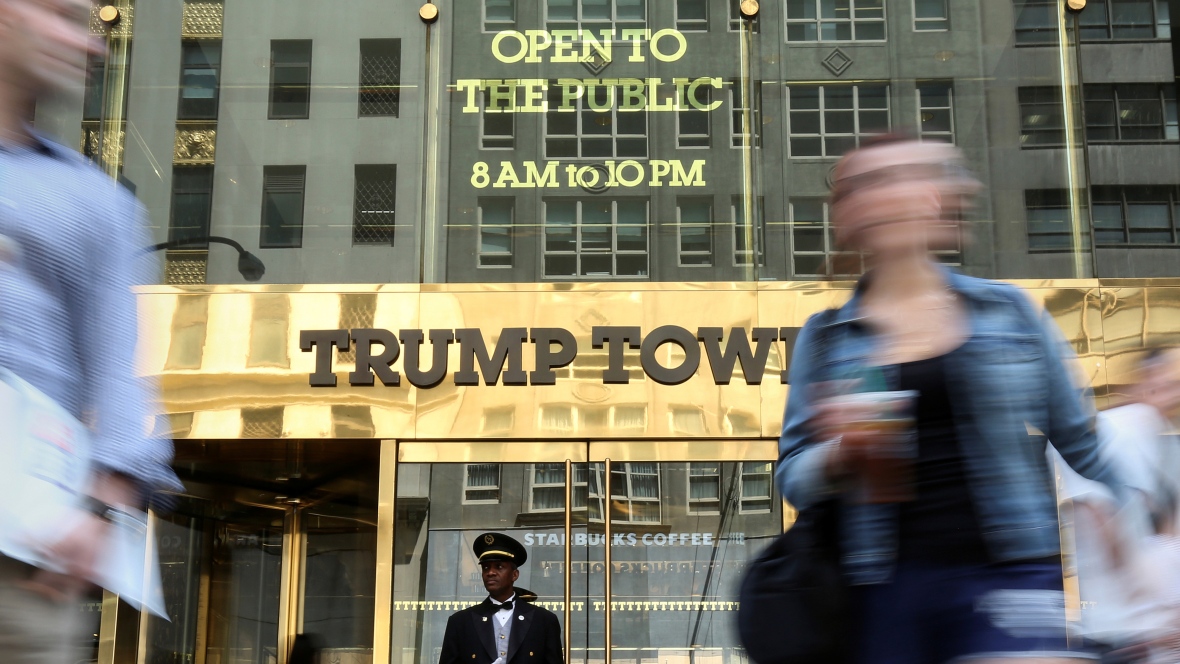
Siguiendo con el tema de los POPS (Privately Owned Public Spaces) que introdujimos en el artículo anterior, en este caso queríamos abordar un ejemplo particular que ilustra el debate abierto en torno a este tipo de espacios: el espacio público de la Trump Tower, el edificio insignia del actual presidente de los Estados Unidos, Donald Trump.

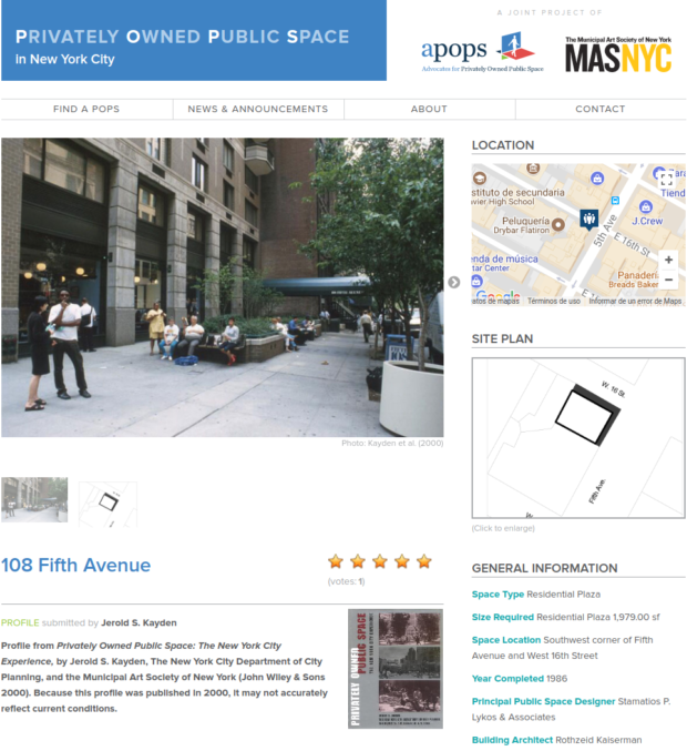
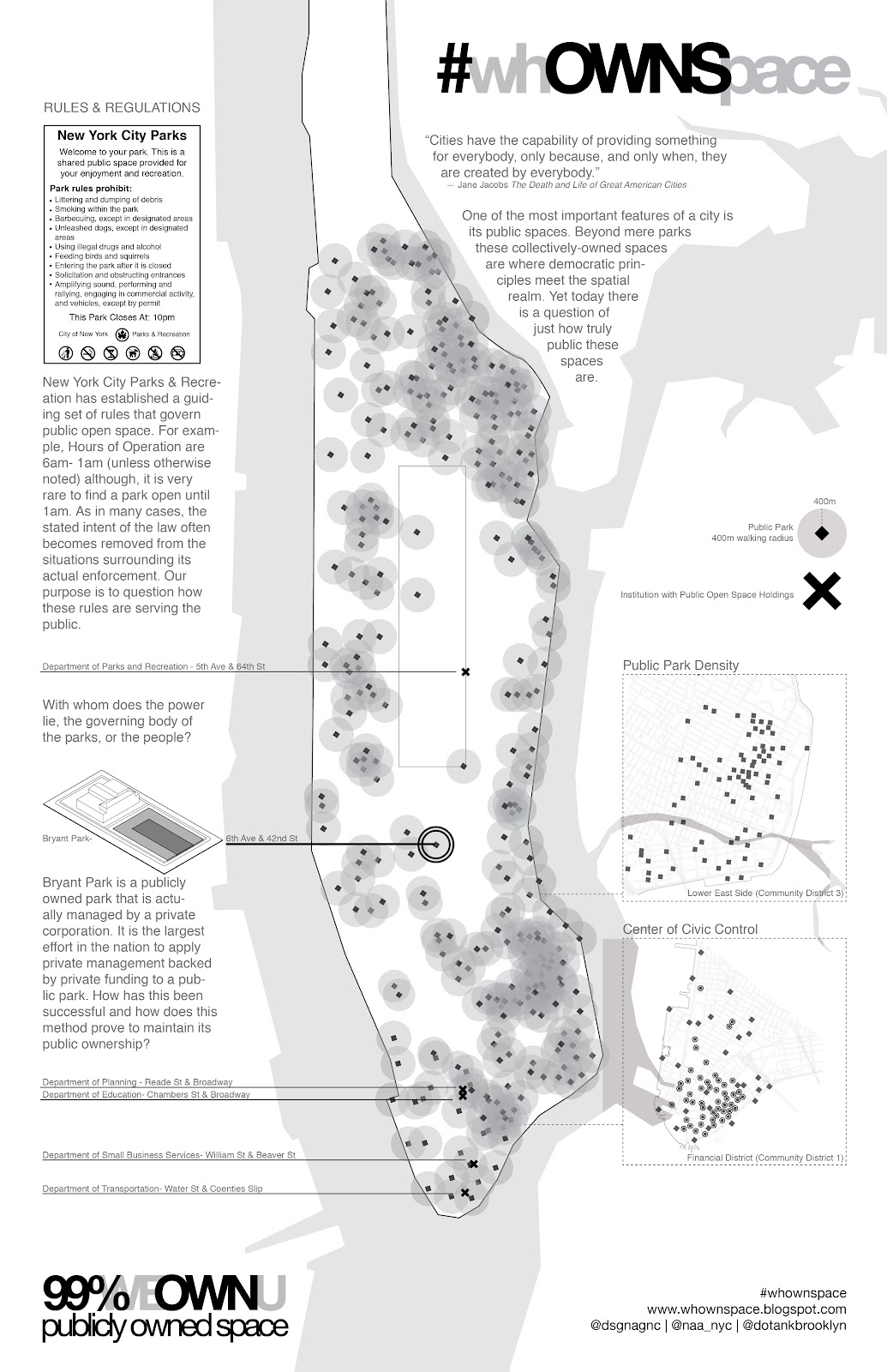
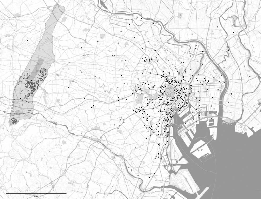
El rascacielos posee uno de los 525 POPS (Espacios públicos de propiedad privada) de la ciudad de Nueva York, una práctica muy recurrente en el densificado tejido de Manhattan.

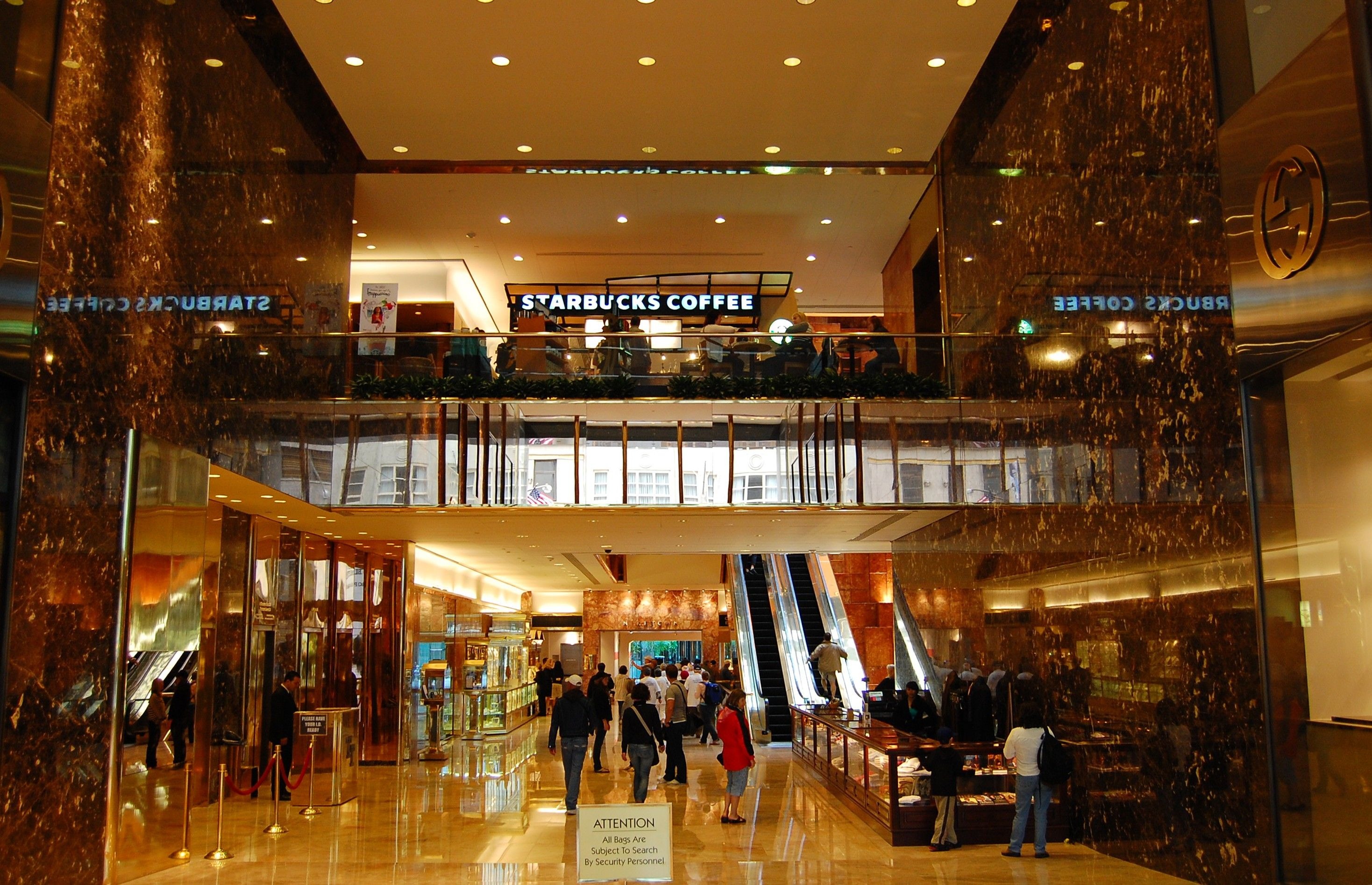
En 1971 Donald Trump se respaldó en este procedimiento para aumentar en 20 plantas la edificabilidad de la ‘Trump Tower’, en el 725 de la Quinta Avenida de Nueva York. A cambio, Trump debía ceder una parte del espacio edificado al uso público, siguiendo una serie de normas estipuladas por la New York City’s Zoning Resolution.

En la práctica, eso significaba que el Vestíbulo Dorado que corresponde a las plantas bajas de su Edificio (la zona escogida para cederse como espacio público) debía contar con algunas características específicas como bancos, vegetación, fuentes, y un mantenimiento adecuado del espacio.

La primera polémica llegó cuando hace algunos años se decidió sustituir el gran banco de mármol negro que presidía la entrada principal por un mostrador de venta de souvenirs de la familia Trump.

Una tienda donde había un banco - Foto: Nick Solares - Curbed.com

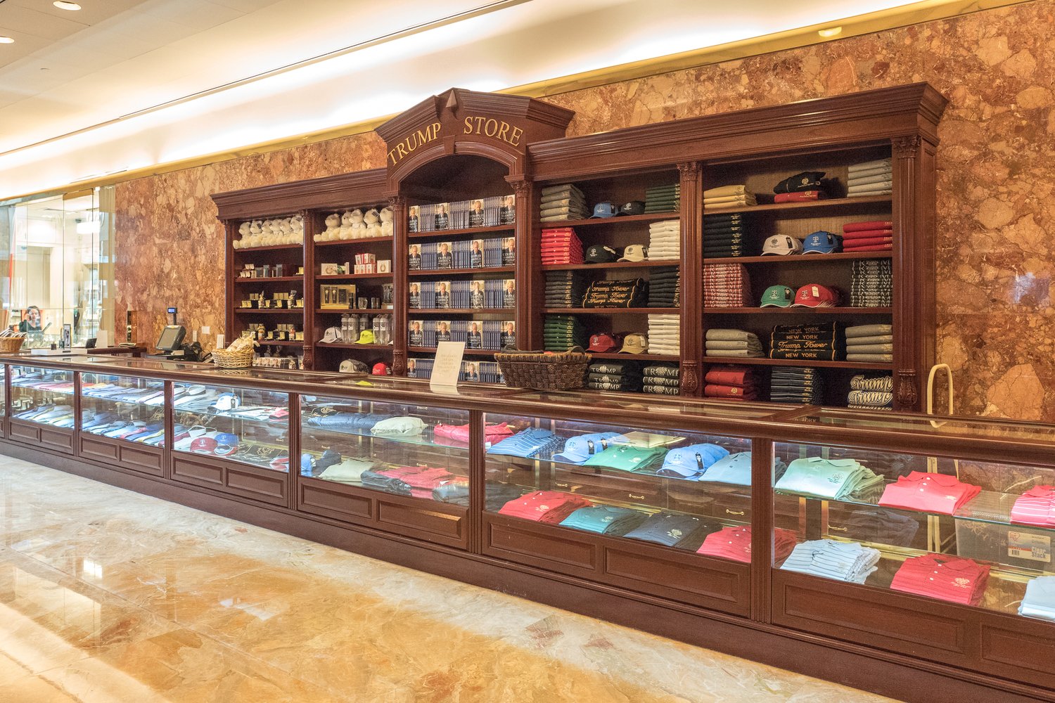
Una tienda donde había un banco – Foto: Nick Solares – Curbed.com

Dotar de zonas de asiento era unos de los pocos requerimientos que exigía el acuerdo que se firmó en 1960 para aumentar la edificabilidad de la Trump Tower, y ese banco era la la solución propuesta por el equipo de Trump para dotar de asientos al POPS. Tras las quejas de varias asociaciones, artículos de protesta en el New York Times o en el Wall Street Journal y una sanción administrativa por parte del Ayuntamiento de Nueva York, se repuso una zona de asiento en lugar del puesto comercial.

El uso del banco restringido a la prensa - Foto: Jerold S. Kayden - The Boston Globe

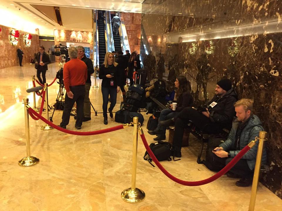
El uso del banco restringido a la prensa – Foto: Jerold S. Kayden – The Boston Globe

Durante la campaña electoral y tras su elección como presidente, sin embargo, el polémico banco ha sido en numerosas ocasiones ocupado por la prensa que aguardaba declaraciones del presidente, permitiendo su uso sólo por personal acreditado.

La decisión de Donald Trump de continuar usando su residencia particular como presidente de los Estados Unidos obliga a reforzar las medidas de seguridad en las zonas cercanas, por lo que las zonas de acceso público cuentan ahora con controles de seguridad y deben desalojarse a menudo para cumplir con los protocolos que protegen al presidente.

Para Jerold Kayden, profesor Harvard y fundador de Advocates for Privately Owned Public Space, estas usurpaciones son lo que rompe los vínculos cívicos que producen ciudad. “Puede parecer insignificante, pero ese banco es un signo para la gente de que este era un espacio público y acogedor”.

La simple capacidad de sentarse y ocupar un espacio simboliza mucho más que el simple hecho de poder estar: representa la posibilidad de sentirse acogido en un espacio y sentirlo más propio, y es un elemento clave para significar un espacio como público.

El banco en uso la ciudadanía - Foto: Wall Street Journal

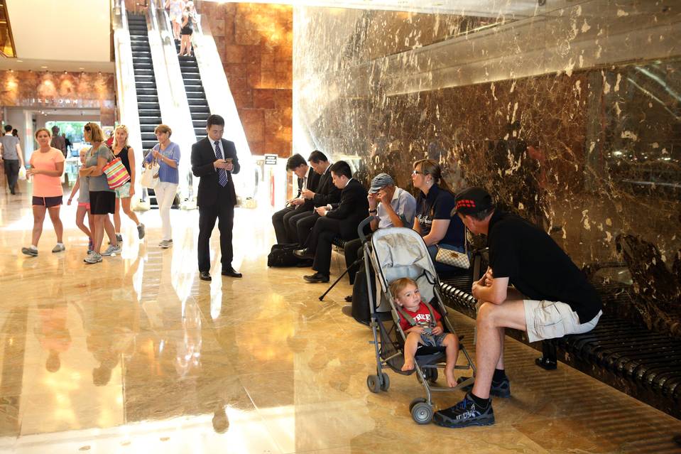
El banco en uso la ciudadanía – Foto: Wall Street Journal

Teniendo en cuenta esto puede comprenderse el revuelo generado tras eliminar o limitar el uso del banco en la entrada de las Trump Tower. La polémica ha llevado incluso a las autoridades locales a aumentar las multas por incumplimiento de la normativa de espacios públicos de propiedad privada.

La regulación de los POPS se enfrenta ahora a una nueva situación en la que el uso de esos espacios públicos se ha reducido de manera drástica y no existe una normativa específica que controle cómo el ámbito privado de un representante público (en este caso, el propio presidente del gobierno) puede o no limitar el uso de estos espacios. Ahora toca definir qué intereses deben anteponerse y cómo se debe actuar para evitar que no se vuelva a limitar el uso de la ciudad a sus ciudadanos.

Comments: (0)

POPS y la Trump Tower | Espacios públicos de propiedad privada I

Category: ⚐ ES+ciudad+urbanismo

Entrada a la Trump Tower – Imagen: Wikimedia Commons

Hace unos pocos meses surgió una gran polémica en EEUU en torno a las restricciones de uso de los espacios públicos dentro de la Trump Tower, residencia del actual presidente de los Estados Unidos.

Hablaremos más adelante del caso concreto de Trump, pero antes conviene contextualizar el régimen que rige estos espacios: los “POPS” son una práctica muy frecuente en Manhattan, pero también en otras partes del mundo. ¿En qué consisten?

Manhattan y los POPS

Los POPS, o Privately Owned Public Spaces, son espacios exteriores o interiores provistos para uso público por una entidad o propietario privado de un edificio a cambio de una concesión en la edificabilidad del solar. Este procedimiento conlleva generar espacios de uso público siguiendo una serie de requerimientos, y fue implantada en 1961 para revitalizar el crecimiento inmobiliario de Manhattan. Desde entonces, la ciudad ha generado entorno a 525 espacios con estas características, generando un área pública total para la ciudad de más de 32 Hectáreas, lo que corresponde a ¼ de Central Park.

Las características de estos espacios varían enormemente en cada caso ya que suelen ser fruto de negociaciones concretas entre los emprendedores privados y la administración local (New York City Department of Buildings y New York City Department of City Planning).

Sin embargo, el mantenimiento de las características que hacen que estos espacios se entiendan como públicos no siempre se ha mantenido de acuerdo a la regulación pactada y, como se ha demostrado posteriormente, la Administración de Nueva York no ha llevado una cuidada vigilancia de estas zonas.

En el año 2000 el abogado y profesor de la Universidad de Harvard, Jerold S. Kayde (fundador de la organización Advocates for Privately Owned Public Space) realizó una investigación en torno a los POPS en colaboración con el New York City Department of City Planning y la Municipal Art Society of New York, catalogando cada uno de los espacios y su situación con respecto a la normativa que los rige.

Ejemplo de ficha de un espacio público de propiedad privada – clic para ver la original

El libro resultante, “Private Owned Public Space: The New York City Experience” (New York: John Wiley & Sons, 2000) contenía dos conclusiones principales: aunque los acuerdos de zonificación produjeron una cantidad impresionante de espacio público para la ciudad, la calidad de esos espacios dejaba mucho que desear y. lo que es aún peor, un número significativo de propietarios habían privatizado ilegalmente sus espacios públicos. Una auditoría de 2017 confirma estos puntos.

Según los datos publicados en su página web, el estudio mostraba que un 41% de ellos no superaba los criterios mínimos de calidad. La Normativa de Zonificación de 1961 no imponía una normativa concisa entorno al mantenimiento de los POPS, por lo que los propietarios no estaban obligados a preservar las zonas de acceso público ni a considerar la cualidad de aspectos esenciales de esas áreas (asientos, jardinería, materiales, orientación, soleamiento, etc.). En los años 70, influenciados por el trabajo del urbanista norteamericano William H. Whyte y su Proyecto “Vida en la Calle”, los funcionarios de la Ciudad mejoraron la normativa incluyendo requisitos de asientos, jardinería, bastidores para bicicletas, fuentes de agua potable y placas de identificación.

El estudio contenía como segunda conclusión el hecho de que muchos propietarios redujeron o impidieron el uso público de sus POPS a través de acciones ilegales de privatización. En el 50% de los edificios con POPS, al menos uno de los espacios denominados como tal habían sido cerrados al público.

Estas acciones de privatización podían ser de tres tipos: negación del acceso público (puertas bloqueadas impidiendo el acceso durante las horas en las que debería permanecer abierto, representantes del edificio informando incorrectamente sobre la posibilidad de acceso, baños públicos señalizados sólo para residentes), ocupación del espacio público por usos privados adyacentes (obligación de consumir en espacios de estancia públicos) y disminución de los servicios requeridos.

Los estándares de los POPS

En el 2007, y tras la publicación del estudio, el New York City Zoning Resolution definió unos estándares de calidad mucho más concretos, que pueden consultarse a través de su página web y de los que vamos a exponer algunos de sus puntos más interesantes:

  • Para facilitar su entendimiento como espacio público, los POPS deben tener al menos un 50% de visibilidad desde la calle.
  • Para evitar que espacios residuales del edificio se consideren como POPS, éstos no pueden ser menores a 4,5 m en ninguna de sus dimensiones.
  • Para favorecer el uso de los espacios, está prohibido proteger las zonas potenciales de asiento.
  • Para aclarar su condición pública es obligatorio incluir una placa informativa con horarios de uso.

61/2 POPS

En 2012 el Ayuntamiento de Nueva York empezó a llevar a cabo una propuesta de unificar los POPS entre la calle 51 y la 57, y entre la Sexta y la Séptima Avenida. El objetivo era vincular espacios públicos previamente no conectados y agregar cruces de peatones y otras mejoras en seguridad y señalización, creando entre otras cosas la dirección “6th Ave ½” (un guiño humorístico al andén 9 y ¾ de Harry Potter).

POPS y activismo

El concepto de Ciudad que genera la proliferación de POPS y la privatización (aunque sólo en propiedad y no en uso) del espacio público es un aspecto a tener en cuenta. Tercerizar el diseño y gestión (aunque sean regulados) de los espacios públicos de la ciudad aumenta la falta de control sobre la toma de decisiones y la realización de estrategias urbanas a mayor escala que respondan a problemas urbanos más complejos que los de cada espacio individual.

Numerosos proyectos y colectivos ponen critican estos modelos de gestión evidenciando ambigüedades y controversias. Los que siguen son sólo algunos de ellos.

En 2011 el Estudio Graham Coreil-Allen lanzó una convocatoria en Kickstarter para realizar Arcade Parade, una “procesión” por algunos de los POPS de Manhattan para reivindicar y visibilizar estos espacios como públicos utilizando la ironía y haciendo un llamamiento a artistas y performers para colaborar en el evento.

The Arcade Parade – Vídeo

En las protestas de “Occupy Wall Street” los manifestantes fueron desalojados de POPS sin existir una clara regulación sobre este tipo de situaciones. De esa situación nació el grupo de trabajo whOWNSpace coordinado por DSGN AGNC. Su objetivo es cuestionar las reglas, a menudo conflictivas, que rigen estos espacios, proponiendo políticas alternativas, usos y diseños para el espacio que fomenten su uso público.

¿De quién son los espacios libres? – Fuente: whOWNSpace.blogspot.com

En 2013 el Center for Sustainable Urban Regeneration de la Universidad de Tokyo editó el libro “Privately Owned Public Space: The International Perspective”  (que se puede descargar gratuitamente aquí) donde se analizaban las normativas y estructuras que rigen este tipo de espacios en diferentes ciudades: Santiago de Chile, Seattle, Aquisgrán, Bangkok, Hong Kong o Tokio.

Cada punto representa un POPS. La comparación muestra que los POPS en Manhattan están mucho más concentrados que en Tokyo. Fuente: Privately Owned Public Space: The International Perspective.

En la segunda parte de este artículo indagaremos en el caso concreto de la Trump Tower para ejemplificar algunas de las dudas o polémicas más habituales en torno a estos espacios.

Comments: (0)

Planning for protest | Time to get the book and visit the exhibition!

Category: ⚐ EN+news+publications

Planning for Protest

A volley of protests have taken place throughout the world since 2008, the symbolic catalyst being the financial crisis triggered by the collapse of the multinational banking systems. We are now in an era of particularly well thought-out and networked mass movements that through the convenience of a digital news cycle can be followed more closely than ever before. Planning for Protest takes an closer look at how public spaces shape both the physical and psychological backdrop of these public events.

12 architectural offices in 12 cities across the globe have examined the role of architecture in shaping, defining, or limiting the flow of protest within their respective cities. Each contributor rendered eight drawings exploring a proposal for their city, focused on a specific intervention or urban planning scale. Varying from historical studies to proposals for a radical reshaping of space for public discourse, Planning for Protest is an ongoing documentation of how the physical world around us both limits and can be transcended by the people at any given time.

PlannignforProtest_invite2_620

Planning for Protest takes shape as an publication and exhibition. The opening event and publication launch of this Associated Project of the Lisbon Architecture Triennale will be on September 14 at 17:00. There will be a guided visit on September 15 at 12:00. The exhibition runs from September 12—December 15, 2013.

The publication is designed by Project Projects and will be available at the opening. It consists of a portable version of the exhibition and features essays by Daniel Oliveira and Pedro Levi Bismarck.

Interested? It is currently open to purchase and support through a crowdfunding campaign. By purchasing the publication you will be supporting Planning for Protest: all proceeds will be used for funding the public program. If you will not be in Lisbon next week, you can order a copy and support the project on the Indiegogo page until next Sunday, September 15.

Organized by Ben Allen, James Bae, Ricardo Gomes (KWY), Shannon Harvey (Public Address) and Adam Michaels (Project Projects), Planning for Protest is an ongoing documentation of how the physical world around us both limits and can be transcended by the people at any given time. Download the press release here.

Participants: Antonas Office (Athens), Studio Miessen (Berlin), studioBASAR (Bucharest), CLUSTER (Cairo), Culturstruction (Dublin), SUPERPOOL (Istanbul), ateliermob (Lisbon), public works with Isaac Marrero-Guillamón (London), Ecosistema Urbano (Madrid), Srdjan Jovanović Weiss / NAO (New York), PioveneFabi with 2A+P/A (Rome) and Vapor 324 (São Paulo).

Location of the exhibition: Rua dos Douradores 220, Praça da Figueira, Lisbon, Portugal

www.planningforprotest.org 
www.facebook.com/PlanningForProtest

Comments: (0)

MetaMap | MyBlockNYC, interview with Alex Kalman

Category: ⚐ EN+city+Intervista+MetaMap+video

Today we present a New York based video mapping project, MyBlockNYC. They define their project as:

MyBlockNYC.com is an interactive video mapping website that captures and presents personal video accounts of life and culture in New York City in order to create an intimate, evolving, and complete portrait of the great city. Users upload videos geographically, creating the first fully interactive video map of New York City.

The MyBlock Assignment is:

Share the moments you see on the wild streets of New York City. You can upload videos you already have on your cell phone and computer, or explore the city and capture what you see. Each video should be shot outdoors and take place on a single block.

I interviewed Alex Kalman, founder of the platform.

Here’s a few examples of videos on the platform:

The Holland Tunnel

Grandma Tracy breakdancing at Mad Decent block party

Jimmy Justice

This is the second post in the MetaMap series about mapping. You can follow the conversation on Twitter, Google+, Diaspora, or Facebook through the #metamap hashtag.

Comments: (0)

A Day at New York’s BMW Guggenheim Lab: A Grassroots Example of Creative Urban Development

Category: ⚐ EN+open culture+Uncategorized+urban social design

In Manhattan, on the corner of Houston and 2nd avenue, there sits an empty lot between two brick buildings. For nearly a century, the lot has existed as a eye-sore for its neighbors, and a nest for lower east side rats. However, today it exists, cleared, paved and transformed into the temporary host of the BMW Guggenheim lab.

Between gratified walls, a massive steel structure, flat screen monitors and a speaker’s podium hosts guests and events that critique and inspire new ideas about 21st century creative urbanism. I had been meaning to visit the BMW Guggenheim lab since, while in Germany this past summer, a friend told me about it’s opening. After New York, the structure and monitors will be traveling to Berlin, and then on Mumbai. In fact, the structure and events are scheduled to travel around the world to 9 major cities for the next 6 years.

And what will become of the lot on Houston and 2nd? As I am currently researching the temporary use of vacant urban spaces, this question had been on my mind. I arrived in New York, serendipitously in time for the “What’s Next” discussions at the Lab. it turns out, the vacant lot owns a history of transformation efforts that extend beyond this past summer and BMW or the Guggenheim’s involvement. First Street Green, a local community organization made up of neighbors and friends of the area, has been trying to clean up and redesign the lot as community space for several years.

I choose the right time to visit. The day’s events kicked off with an address from First Street Green’s President, Robert Graf, who spoke a bit about the history of the 33 East first street site and their efforts to work with New York City Parks and Recreational facilities (who has owned the property since the mid 20th century) to clear and adapt the space to neighborhood needs. Next, friends of First Street Green, architects Jorge Prado and Silva Ajemian of Todo Design, presented a potential blueprint for the future of the site. Melding local neighborhood interests and the larger interests of New York City, they suggested a simple split-level architectural design: half community center and half park-space that would integrate the activities on the bustling Houston street with the first street neighborhood.

Then a representative from Art in the Parks, a project headed by the Department of Art and Antiquities, gave a presentation about the type of sculptures and installations that have been showcased throughout New York’s parks in the past. This presentation was meant to suggest the potential for the space to be used for arts viewing. A young, neighborhood boy raised his hand – and then the real discussions began. “What about the kids?” He asked, “we don’t want to look at sculptures, we want to play sports in our neighborhood”. It was quickly acknowledged that whatever becomes of the space, it will have to meet the needs of the surrounding residents, first and foremost.

It seemed the perfect transition into the presentation “It’s My Park”. The Hester Street Collaborative and Partnership for Parks were presented by Jordan Pender, who explained placemaking – the community benefits of citizen involvement in urban development plans. Along the same lines as the What If Cities initiative at Ecosistema Urbano, Partnerships for Parks now has an online interface called “People Make Parks” which encourages communities participate in the design of their park, incorporating tools like “Design Hoops”, “story map”s and “wish objects”. Lastly, Graem Sullivan, director of the School of Visual Arts and The Pennsylvania State University spoke about the significance as Space for making place for questions.

After a lunch break and a on-site game of Urbanology (it’s great, play it online here), the activities on site switched to a visioning wall workshop. Several tables laid out giant foam puzzle pieces and writing and decorating tools. Speakers, listeners, and passer-bys were encouraged to write their own ideas about what could exist in the space post-BMW/Guggenheim Lab. The puzzle pieces took structure, and the sculpture chart grew in idea potential that raged from Mobile Gardening to Music performance.

The puzzle pieces, we were told, would be presented to the 1st street community, who would lay the ideas in order of preference. The site’s development would depend on this input.

I observed two major take-away points from the First Street Green day’s activities:

First, the potential in the flexible use of raw spaces. Architects Prado and Ajemian suggested a “soft “structure for their proposed community center. Natural materials and a simple structure would allow for later construction or deconstruction. In other words, the architecture of the site could be planned from the beginning to adapt to neighborhood needs. Art in the Parks suggested the idea of installation, not murals or permanent sculpture to share the space. This art form could temporarily expose the neighborhood (and New York’s visitors) to contemporary visual art during periods of the year that the space is unsuitable for lengthy outdoor activities.

Second, the potential of socially engaging tools to integrate local (and larger) communities in urban development plans. These tools give all members of the community, regardless of age or educational status, the ability to impact the future of their shared space. Community members will likely care even more for a space they’ve invested thought into. The more stakeholders in a project, the less likely it will fall into disuse or vandalism.

Ecosistma Urbano is well acquainted with the notion that fluid communication between designers and the communities in which they work is one of the most important aspects of 21st century, sustainable urban development. At DreamHamar’s digital and physical labs, similar social tools are being introduced.

The history of the 33 East first street is, in itself, proof of the potential in communities to develop grassroots urban change. Until mid-October, if you’re in New York, I highly recommend checking out the BMW Guggenheim lab

If you’re in New York some months, years from now, it will interesting to see what becomes of the 33 East first street site as well.

Comments: (0)

La ciudad en cómics: Saul Steinberg

Category: ⚐ ES+arte+city+eu:comic

Hoy os presento a este magnífico dibujante y humorista, a través de dos de sus viñetas en las que refleja su particular visión de la ciudad.

Más información sobre Saul Steinberg:

The Saul Steinberg Foundation

Wikipedia

continue reading

Comments: (4)

Urbanomnibus.net is live!

Category: ⚐ EN+urbanism

090109_urbanomnibus

Welcome to this new project of the Architectural League of New York. Come see what we’re all about. Explore, read, listen, watch, and join in the conversation. We encourage your input – this is a soft launch, and we will be relying on your feedback to help us keep making the site better. continue reading

Comments: (2)

Miroslav Sasek – This is New York

Category: ⚐ ES+city+educación

Os recomiendo este libro de M. Sasek. “This is New York” es un libro de 1960 que presenta la ciudad de Nueva York a los niños. Pertenece a una serie de libros sobre ciudades: “This is…” continue reading